Hiking trails in Osttirol

Discover the most popular hiking trails

filter results
more filter otions
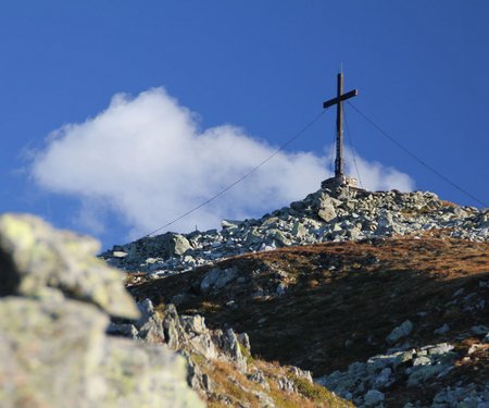
starting point:
Patsch
destination point:
Jagdhausalm
highest point:
2014 m
total walking time
5 h
distance
16.6 km
🔋
altitude meters uphill
400 hm
🞽
difficulty
easy
starting point:
Jausenstation Mooseralm
destination point:
Jausenstation Mooseralm
highest point:
2881 m
total walking time
2 h
distance
3.8 km
🔋
altitude meters uphill
440 hm
🞽
difficulty
average
starting point:
Innervillgraten, Kalkstein
destination point:
Toblacher Pfannhorn
highest point:
2650 m
total walking time
4:30 h
distance
9.8 km
🔋
altitude meters uphill
1020 hm
🞽
difficulty
average
highest point:
1428 m
total walking time
2:30 h
distance
8.7 km
🔋
altitude meters uphill
41 hm
🞽
difficulty
easy
starting point:
Bruggen (St. Veit)
destination point:
Gassen
highest point:
1569 m
total walking time
3:30 h
distance
9.4 km
🔋
altitude meters uphill
440 hm
🞽
difficulty
average
starting point:
Cable railway mountain hut
destination point:
Golzentipp
highest point:
2287 m
total walking time
2 h
distance
5.6 km
🔋
altitude meters uphill
230 hm
🞽
difficulty
easy
starting point:
Mountain rescue hut cable railway Thurntaler
destination point:
Mountain rescue hut cable railway Thurntaler
highest point:
509 m
total walking time
3:30 h
distance
9.8 km
🔋
altitude meters uphill
460 hm
🞽
difficulty
easy
starting point:
Parking lot Rauchenbach/Kartitsch
destination point:
Gr. Kinigat
highest point:
2567 m
distance
8.5 km
🔋
altitude meters uphill
1250 hm
🞽
difficulty
difficult
starting point:
Volkzeiner Hütte
destination point:
Gr. Degenhorn
highest point:
2920 m
total walking time
6:30 h
distance
13 km
🔋
altitude meters uphill
1130 hm
🞽
difficulty
difficult
starting point:
Kartitsch
destination point:
Untertilliach
highest point:
1632 m
total walking time
4 h
distance
15.9 km
🔋
altitude meters uphill
210 hm
🞽
difficulty
average
starting point:
Dorfzentrum Anras
destination point:
Dorfzentrum Anras
highest point:
1373 m
total walking time
2:30 h
distance
6.7 km
🔋
altitude meters uphill
310 hm
🞽
difficulty
easy
starting point:
Kalksteinq
destination point:
St. Magdalena / Gsiesertal
total walking time
5 h
distance
7 km
🔋
altitude meters uphill
800 hm
🞽
difficulty
average
starting point:
Mountain rescue hut Steinermandl Sessellift
destination point:
Schleinitz
highest point:
2890 m
total walking time
3:30 h
distance
9.1 km
🔋
altitude meters uphill
750 hm
🞽
difficulty
difficult
starting point:
Ulrichsbichl, Amlach
destination point:
Ulrichsbichl, Amlach
highest point:
890 m
total walking time
2:30 h
distance
8.1 km
🔋
altitude meters uphill
260 hm
🞽
difficulty
average
starting point:
Zettersfeld Talstation
destination point:
Zettersfeld Talstation
highest point:
1340 m
total walking time
3 h
distance
8.5 km
🔋
altitude meters uphill
700 hm
🞽
difficulty
average
state: closed
starting point:
Defreggerhaus
destination point:
Großvenediger
highest point:
3657 m
total walking time
4 h
distance
8.1 km
🔋
altitude meters uphill
680 hm
🞽
difficulty
difficult
starting point:
Infobüro Virgen
destination point:
Infobüro Virgen
highest point:
1180 m
total walking time
1 h
distance
3.5 km
🔋
altitude meters uphill
130 hm
🞽
difficulty
easy
starting point:
Trogach
destination point:
Seespitze
highest point:
3021 m
total walking time
8:30 h
distance
14.4 km
🔋
altitude meters uphill
1310 hm
🞽
difficulty
difficult
starting point:
hut, Dolomitenhütte
destination point:
hut, Karlsbaderhütte
highest point:
2260 m
total walking time
5 h
distance
10.3 km
🔋
altitude meters uphill
780 hm
🞽
difficulty
difficult
starting point:
St. Jakob/Trogach
destination point:
Seespitzhütte
highest point:
2367 m
total walking time
6 h
distance
14.1 km
🔋
altitude meters uphill
834 hm
🞽
difficulty
average
starting point:
Kals Parkplatz Taurer
destination point:
Kalser Tauernhaus/Stotzbachfall
highest point:
1930 m
total walking time
4:30 h
distance
14.5 km
🔋
altitude meters uphill
320 hm
🞽
difficulty
easy
starting point:
Prägraten Parkplatz Ströden (Maut)
destination point:
Umbalfälle
highest point:
1660 m
total walking time
2:30 h
distance
5.8 km
🔋
altitude meters uphill
250 hm
🞽
difficulty
easy
starting point:
Alpengasthof Oberhaus
destination point:
Optional Verlänergung bis Jagdhausalmen
highest point:
1790 m
total walking time
40 min
distance
1.5 km
🔋
altitude meters uphill
20 hm
🞽
difficulty
easy
starting point:
Parkplatz Seichenbrunn
destination point:
Lienzer Hütte
highest point:
1970 m
total walking time
2:30 h
distance
7.6 km
🔋
altitude meters uphill
315 hm
🞽
difficulty
easy
starting point:
Kals Großdorf
destination point:
Kals Taurerwirt
highest point:
1490 m
total walking time
2 h
distance
4.3 km
🔋
altitude meters uphill
130 hm
🞽
difficulty
easy
starting point:
Lucknerhaus Kals
destination point:
Lucknerhütte
highest point:
2030 m
total walking time
1 h
distance
1.8 km
🔋
altitude meters uphill
90 hm
🞽
difficulty
easy
starting point:
Almhütte Leckfeldalm
destination point:
Sillianer Hütte
highest point:
2447 m
total walking time
3 h
distance
5.9 km
🔋
altitude meters uphill
520 hm
🞽
difficulty
average
starting point:
Sport- und Freizeitzentrum
destination point:
Pfannspitze
highest point:
2678 m
total walking time
6:30 h
distance
14.4 km
🔋
altitude meters uphill
1250 hm
🞽
difficulty
average
starting point:
Parkplatz Jausenstation Unterstalleralm
destination point:
Oberstalleralm
highest point:
1864 m
total walking time
50 min
distance
2.8 km
🔋
altitude meters uphill
170 hm
🞽
difficulty
easy
starting point:
car parking "Fahbrücke"
destination point:
Gölbnerblick Hütte
highest point:
1824 m
total walking time
1:30 h
distance
4.2 km
🔋
altitude meters uphill
290 hm
🞽
difficulty
average
starting point:
Reiterstube im Winkeltal
destination point:
Volkzeinerhütte
highest point:
1886 m
total walking time
3:30 h
distance
13.4 km
🔋
altitude meters uphill
370 hm
🞽
difficulty
easy
starting point:
Railway station Sillian
destination point:
Wichtelpark Sillian
highest point:
1121 m
total walking time
45 min
distance
2.6 km
🔋
altitude meters uphill
20 hm
🞽
difficulty
easy
starting point:
Parking lot St. Oswald
destination point:
Parking lot St. Oswald
highest point:
2115 m
total walking time
5:30 h
distance
17.6 km
🔋
altitude meters uphill
770 hm
🞽
difficulty
average
starting point:
Sillian centre
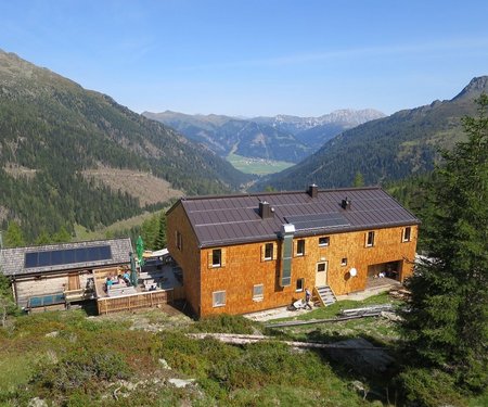
destination point:
Sillian centre
highest point:
1345 m
total walking time
2:30 h
distance
9.6 km
🔋
altitude meters uphill
270 hm
🞽
difficulty
easy
starting point:
Stalpen / Sillian
destination point:
Thurntaler 2.400 m
highest point:
2400 m
total walking time
7 h
distance
14 km
🔋
altitude meters uphill
1330 hm
🞽
difficulty
average
starting point:
Bahnhof Sillian
destination point:
Leckfeldalm
highest point:
1925 m
total walking time
4 h
distance
4.5 km
🔋
altitude meters uphill
830 hm
🞽
difficulty
average
starting point:
Leckfeldalm Hütte
destination point:
Heimkehrerkreuz
highest point:
2352 m
total walking time
3 h
distance
5.6 km
🔋
altitude meters uphill
450 hm
🞽
difficulty
difficult
starting point:
Jausenstation Unterstalleralm
destination point:
Jausenstation Unterstalleralm
highest point:
2453 m
total walking time
3:30 h
distance
7.8 km
🔋
altitude meters uphill
790 hm
🞽
difficulty
average
starting point:
Heinfels / Tessenberg
destination point:
Tessenberger See
highest point:
2124 m
total walking time
5 h
distance
12.8 km
🔋
altitude meters uphill
800 hm
🞽
difficulty
easy
starting point:
Bushaltestelle beim Hotel Weiler
destination point:
Porzehütte
highest point:
1930 m
total walking time
1 h
distance
1.5 km
🔋
altitude meters uphill
250 hm
🞽
difficulty
average
starting point:
Ortsteil Fronstadl / Strassen
destination point:
Fronstadler Alm
highest point:
2025 m
total walking time
4 h
distance
15.19 km
🔋
altitude meters uphill
700 hm
🞽
difficulty
easy
starting point:
Parkplatz Jausenstation Unterstalleralm
destination point:
Weiße Spitze
highest point:
2935 m
total walking time
7 h
distance
9.3 km
🔋
altitude meters uphill
1260 hm
🞽
difficulty
difficult
highest point:
2589 m
total walking time
5 h
🞽
difficulty
difficult
starting point:
Innervillgraten, Kalkstein
destination point:
Kreuzspitze
highest point:
2591 m
total walking time
4:30 h
distance
10.5 km
🔋
altitude meters uphill
980 hm
🞽
difficulty
average
starting point:
Untertilliach
destination point:
Untertilliach
highest point:
2040 m
total walking time
4 h
distance
11.5 km
🔋
altitude meters uphill
830 hm
🞽
difficulty
easy
starting point:
Parkplatz Jausenstation Unterstalleralm
destination point:
Rote Spitze
highest point:
2919 m
total walking time
5:30 h
distance
10.2 km
🔋
altitude meters uphill
1260 hm
🞽
difficulty
average
starting point:
Kalkstein
destination point:
Marchkinkele
highest point:
2545 m
total walking time
4 h
distance
9.2 km
🔋
altitude meters uphill
900 hm
🞽
difficulty
average
starting point:
Artificial lake Strassen
destination point:
Artificial lake Strassen
highest point:
1074 m
total walking time
30 min
distance
1.8 km
🔋
altitude meters uphill
10 hm
🞽
difficulty
easy
starting point:
Hollbruck
destination point:
Graveyard Hochgränten
highest point:
2555 m
total walking time
9 h
distance
10.8 km
🔋
altitude meters uphill
1350 hm
🞽
difficulty
average
starting point:
Biathlonzentrum Obertilliach
destination point:
Hoher Bösring
highest point:
2324 m
total walking time
3 h
distance
6.4 km
🔋
altitude meters uphill
940 hm
🞽
difficulty
average
starting point:
Parkplatz Rauchenbach/Kartitsch
destination point:
Filmoor Standschützenhütte
highest point:
2411 m
total walking time
7 h
distance
8 km
🔋
altitude meters uphill
1300 hm
🞽
difficulty
average
starting point:
Ortsteil Abfaltern / Abfaltersbach
destination point:
Schönfeldalm
highest point:
2250 m
total walking time
6 h
distance
13.9 km
🔋
altitude meters uphill
900 hm
🞽
difficulty
easy
starting point:
Anras
destination point:
Gumriaul
highest point:
2887 m
total walking time
7:30 h
distance
15.9 km
🔋
altitude meters uphill
1640 hm
🞽
difficulty
average
starting point:
Bergen/Flatsch
destination point:
Steinrastl
highest point:
2184 m
total walking time
4:30 h
distance
6.5 km
🔋
altitude meters uphill
710 hm
🞽
difficulty
easy
starting point:
Parkplatz Kristeinertal
destination point:
Gölbner
highest point:
2918 m
total walking time
6:30 h
distance
10.6 km
🔋
altitude meters uphill
1430 hm
🞽
difficulty
difficult
starting point:
Pfaffenboden
destination point:
Spitzköfele
highest point:
2314 m
total walking time
4:30 h
distance
7.8 km
🔋
altitude meters uphill
800 hm
🞽
difficulty
average
starting point:
Soldhäuser Untertilliacher
destination point:
Reiterkarspitz
highest point:
2422 m
total walking time
7 h
distance
19.4 km
🔋
altitude meters uphill
1200 hm
🞽
difficulty
average
starting point:
Soldhäuser Untertilliach/Winkl
destination point:
Hochspitz
highest point:
2581 m
total walking time
7 h
distance
8.8 km
🔋
altitude meters uphill
1350 hm
🞽
difficulty
difficult
starting point:
Cable car Thurntaler
destination point:
3 Seen
highest point:
2270 m
total walking time
1:30 h
distance
3 km
🔋
altitude meters uphill
170 hm
🞽
difficulty
easy
starting point:
Parkplatz Volkzeinerhütte
destination point:
Hochgrabe
highest point:
2925 m
total walking time
6:30 h
distance
11.2 km
🔋
altitude meters uphill
1080 hm
🞽
difficulty
average
starting point:
Adler Lounge / Bergbahnen Kals
destination point:
Adler Lounge / Bergbahnen Kals
highest point:
2762 m
total walking time
3 h
distance
3.9 km
🔋
altitude meters uphill
383 hm
🞽
difficulty
difficult
starting point:
Junior high school St. Jakob
destination point:
Wetterkreuz
highest point:
2208 m
total walking time
5:30 h
distance
6 km
🔋
altitude meters uphill
820 hm
🞽
difficulty
average
starting point:
Parking place Glanz
destination point:
Parking place Glanz
highest point:
1950 m
total walking time
5 h
distance
11.9 km
🔋
altitude meters uphill
640 hm
🞽
difficulty
easy
starting point:
Kapelle Maria Hilf
destination point:
Deferegger Pfannhorn
highest point:
2820 m
total walking time
8:30 h
distance
14 km
🔋
altitude meters uphill
926 hm
🞽
difficulty
difficult
starting point:
Ortsteil Leiten/Obertilliach
destination point:
Leiter Wiesen
highest point:
2037 m
distance
4.9 km
🔋
altitude meters uphill
560 hm
🞽
difficulty
easy
starting point:
Erasmuskapelle in Thurn/Prappernite
destination point:
Helenenkirche
highest point:
1270 m
total walking time
2:30 h
distance
4.1 km
🔋
altitude meters uphill
260 hm
🞽
difficulty
easy
starting point:
Chapel of St. Anthony
destination point:
Bruck castle
highest point:
720 m
total walking time
2 h
distance
3.9 km
🔋
altitude meters uphill
50 hm
🞽
difficulty
easy
starting point:
Zettersfeld Talstation
destination point:
Oberlienz/Lesendorf
highest point:
831 m
total walking time
2 h
distance
9.5 km
🔋
altitude meters uphill
180 hm
🞽
difficulty
easy
starting point:
Patirasdorfer Platzl
destination point:
Patirasdorfer Platzl
highest point:
800 m
total walking time
1:30 h
distance
3.8 km
🔋
altitude meters uphill
120 hm
🞽
difficulty
easy
starting point:
Kammerlanderhof in Thurn
destination point:
Kammerlanderhof in Thurn
highest point:
950 m
total walking time
2:30 h
distance
5 km
🔋
altitude meters uphill
170 hm
🞽
difficulty
easy
starting point:
Tammerburg - Lienz
destination point:
Tammerburg - Lienz
highest point:
950 m
total walking time
3 h
distance
7.6 km
🔋
altitude meters uphill
230 hm
🞽
difficulty
easy
starting point:
Görtschach
destination point:
Anna Schutzhaus
highest point:
1985 m
total walking time
9 h
distance
20.5 km
🔋
altitude meters uphill
1338 hm
🞽
difficulty
easy
starting point:
Maria Hilf
destination point:
Alpe Stalle
highest point:
1714 m
total walking time
1:50 h
distance
4.4 km
🔋
altitude meters uphill
280 hm
🞽
difficulty
easy
starting point:
Tourist information Virgen
destination point:
Maria Schnee pilgrimage church
highest point:
1300 m
total walking time
1 h
distance
3.1 km
🔋
altitude meters uphill
90 hm
🞽
difficulty
easy
starting point:
TVB Infobüro Prägraten
destination point:
Hinterbichl Bushaltestelle
highest point:
1340 m
total walking time
2 h
distance
6.7 km
🔋
altitude meters uphill
80 hm
🞽
difficulty
easy
starting point:
Dorfzentrum Innervillgraten
destination point:
Rotes Kinkele
highest point:
2730 m
total walking time
6 h
distance
13 km
🔋
altitude meters uphill
1360 hm
🞽
difficulty
difficult
starting point:
St. Jakob i. D.
destination point:
Gösleswand
highest point:
2912 m
total walking time
9:30 h
distance
25 km
🔋
altitude meters uphill
1510 hm
🞽
difficulty
difficult
starting point:
St. Veit Ort
destination point:
St. Veit Ort
highest point:
2653 m
total walking time
6 h
distance
17 km
🔋
altitude meters uphill
1190 hm
🞽
difficulty
average
starting point:
Kals am Großglockner - Taurer
destination point:
Taurerwirt/Kals am Großglockner
highest point:
1338 m
total walking time
6 h
distance
14.4 km
🔋
altitude meters uphill
495 hm
🞽
difficulty
average
destination point:
Stanzling
highest point:
2662 m
total walking time
5:30 h
distance
6.5 km
🔋
altitude meters uphill
1100 hm
🞽
difficulty
difficult
starting point:
Razell
destination point:
Rajach
highest point:
1720 m
total walking time
2 h
distance
4.3 km
🔋
altitude meters uphill
290 hm
🞽
difficulty
average
starting point:
Dorfbrunnen in Hopfgarten
destination point:
Dorfbrunnen in Hopfgarten
highest point:
1124 m
total walking time
1 h
distance
3.9 km
🔋
altitude meters uphill
20 hm
🞽
difficulty
easy
highest point:
2891 m
total walking time
12 h
distance
9.6 km
🔋
altitude meters uphill
1772 hm
🞽
difficulty
difficult
starting point:
Lesach
destination point:
Lesach
highest point:
2761 m
total walking time
6:30 h
distance
17.6 km
🔋
altitude meters uphill
1583 hm
🞽
difficulty
difficult
starting point:
Maria Hilf
destination point:
Stadtner Mühle
highest point:
1607 m
total walking time
1 h
distance
1.4 km
🔋
altitude meters uphill
218 hm
🞽
difficulty
average
highest point:
2760 m
total walking time
8 h
distance
17.9 km
🔋
altitude meters uphill
1375 hm
🞽
difficulty
average
starting point:
Parkplatz Bodenalm
destination point:
Liegstatt Grießer Oder
highest point:
2130 m
total walking time
3 h
distance
4.3 km
🔋
altitude meters uphill
480 hm
🞽
difficulty
easy
starting point:
Parking place Sägewerk
destination point:
Parking place Sägewerk
highest point:
2350 m
total walking time
6 h
distance
15.2 km
🔋
altitude meters uphill
1090 hm
🞽
difficulty
average
starting point:
Tourist information office Prägraten a.G
destination point:
Centre of Virgen
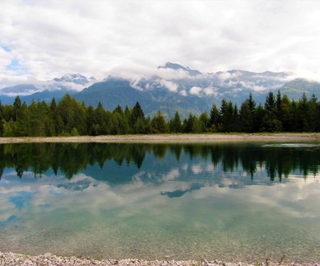
highest point:
1410 m
total walking time
5 h
distance
14.1 km
🔋
altitude meters uphill
500 hm
🞽
difficulty
easy
starting point:
Lienz, Thal, Assling, Parking Spot Wilfernertal
destination point:
Pedretscher Kaser
highest point:
2000 m
total walking time
3 h
distance
9 km
🔋
altitude meters uphill
380 hm
🞽
difficulty
average
starting point:
Village centre Schlaiten
destination point:
Village centre Schlaiten
highest point:
1320 m
total walking time
3:30 h
distance
8.2 km
🔋
altitude meters uphill
560 hm
🞽
difficulty
average
starting point:
TVB Infobüro
destination point:
TVB Infobüro
highest point:
1400 m
total walking time
1:15 h
distance
3.8 km
🔋
altitude meters uphill
120 hm
🞽
difficulty
easy
starting point:
Parkplatz Wilferntal
destination point:
Rotstein
highest point:
2690 m
total walking time
4:30 h
distance
9.9 km
🔋
altitude meters uphill
990 hm
🞽
difficulty
average
starting point:
Goggkreuz
destination point:
Goggkreuz
highest point:
910 m
total walking time
2:30 h
distance
4.2 km
🔋
altitude meters uphill
286 hm
🞽
difficulty
difficult
state: open
starting point:
Pustertaler Straße
destination point:
Reiteralm
highest point:
1193 m
total walking time
2 h
distance
2.7 km
🔋
altitude meters uphill
221 hm
🞽
difficulty
easy
starting point:
Moosalm
destination point:
Böses Weibele
highest point:
2521 m
total walking time
5:50 h
🔋
altitude meters uphill
1520 hm
🞽
difficulty
easy
starting point:
trail station, Bergstation der Einseilumlaufbahn Zettersfeld
destination point:
hut, Rotmannalm
highest point:
2220 m
total walking time
2 h
distance
5.5 km
🔋
altitude meters uphill
400 hm
🞽
difficulty
easy
starting point:
Lienz
destination point:
Neualplsee
highest point:
2470 m
total walking time
2:50 h
distance
6.8 km
🔋
altitude meters uphill
300 hm
🞽
difficulty
easy
starting point:
Roaner Alm
destination point:
Winklerner Almsee
highest point:
2070 m
total walking time
2 h
distance
5.6 km
🔋
altitude meters uphill
230 hm
🞽
difficulty
easy
starting point:
Hut Hochstadel Schutzhütte
destination point:
Hochstadel
highest point:
2660 m
total walking time
5 h
distance
6.2 km
🔋
altitude meters uphill
880 hm
🞽
difficulty
difficult
starting point:
Lienz, valley station Hochsteinbahn
destination point:
hut, Hochsteinhütte
highest point:
2020 m
total walking time
4:30 h
distance
8.2 km
🔋
altitude meters uphill
1010 hm
🞽
difficulty
average
starting point:
Lienz, Leisach, direction Kerschbaumeralm, Parkplatz Klammbrückl
destination point:
Spitzkofel
highest point:
2700 m
total walking time
9 h
distance
16.6 km
🔋
altitude meters uphill
1670 hm
🞽
difficulty
difficult
starting point:
Lienz, Amlach, forest grant
destination point:
Kerschbaumeralm Schutzhaus
highest point:
1900 m
total walking time
8 h
distance
16.8 km
🔋
altitude meters uphill
1500 hm
🞽
difficulty
average
starting point:
Lienz,parking spot Hochsteinbahn
destination point:
Böses Weibele
highest point:
2513 m
total walking time
4 h
distance
10 km
🔋
altitude meters uphill
545 hm
🞽
difficulty
easy
starting point:
Kreithof
destination point:
Lavanter Kolm
highest point:
1920 m
total walking time
5 h
distance
9.4 km
🔋
altitude meters uphill
900 hm
🞽
difficulty
average
starting point:
Lienz, Iselsberg, Parking spot Zwischenbergern-Sattel
destination point:
Zietenkopf
highest point:
2480 m
total walking time
5 h
distance
14.5 km
🔋
altitude meters uphill
1080 hm
🞽
difficulty
average
starting point:
Oberalkus
destination point:
Alkuser See
highest point:
2430 m
total walking time
7:30 h
distance
20 km
🔋
altitude meters uphill
1705 hm
🞽
difficulty
average
starting point:
Gasthof Schöne Aussicht
destination point:
Roaner Alm
highest point:
190 m
total walking time
4 h
distance
10 km
🔋
altitude meters uphill
579 hm
🞽
difficulty
easy
starting point:
05:00
destination point:
hut, Hochschoberhütte
highest point:
3240 m
total walking time
10 h
distance
14.4 km
🔋
altitude meters uphill
1590 hm
🞽
difficulty
difficult
starting point:
Parkplatz Seichenbrunn
destination point:
Petzeck
highest point:
3270 m
total walking time
10 h
distance
16.6 km
🔋
altitude meters uphill
1690 hm
🞽
difficulty
difficult
starting point:
Parkplatz Seichenbrunn
destination point:
Wangennitzsee Hütte
highest point:
2530 m
total walking time
5 h
distance
10.6 km
🔋
altitude meters uphill
880 hm
🞽
difficulty
average
starting point:
Sternalm
destination point:
Hochsteinhütte
highest point:
2020 m
total walking time
3 h
distance
5 km
🔋
altitude meters uphill
520 hm
🞽
difficulty
average
starting point:
Lucknerhaus
destination point:
Lucknerhütte
highest point:
2241 m
total walking time
2:20 h
distance
5.2 km
🔋
altitude meters uphill
320 hm
🞽
difficulty
average
starting point:
Cable railway mountain hut
destination point:
Golzentipp
highest point:
2220 m
total walking time
2 h
distance
3.7 km
🔋
altitude meters uphill
140 hm
🞽
difficulty
easy
starting point:
Parking place Happeck
destination point:
Parking place Happeck
highest point:
1770 m
total walking time
2 h
distance
4.4 km
🔋
altitude meters uphill
260 hm
🞽
difficulty
easy
starting point:
Parking place Matreier Tauernhaus
destination point:
Parking place Matreier Tauernhaus
highest point:
1680 m
total walking time
1:45 h
distance
5.2 km
🔋
altitude meters uphill
170 hm
🞽
difficulty
easy
starting point:
Park possibility Prossegg bridge
destination point:
Kräuterwirtshaus Strumerhof
highest point:
1450 m
total walking time
4:30 h
distance
12.2 km
🔋
altitude meters uphill
510 hm
🞽
difficulty
easy
starting point:
Parking place Matrei i. O. Tauernhaus
destination point:
Parking place Matrei i. O. Tauernhaus
highest point:
2470 m
total walking time
7:45 h
distance
14.8 km
🔋
altitude meters uphill
980 hm
🞽
difficulty
difficult
starting point:
Parkplatz Zedlacher Paradies
destination point:
Parkplatz Zedlacher Paradies
highest point:
1800 m
total walking time
3 h
distance
7.5 km
🔋
altitude meters uphill
360 hm
🞽
difficulty
easy
starting point:
Parking place Guggenberg
destination point:
Parking place Guggenberg
highest point:
1850 m
total walking time
4:30 h
distance
6.7 km
🔋
altitude meters uphill
720 hm
🞽
difficulty
average
starting point:
Parkplatz Großdorf
destination point:
Parkplatz Großdorf
highest point:
2204 m
total walking time
7 h
distance
14.2 km
🔋
altitude meters uphill
851 hm
🞽
difficulty
average
starting point:
Parkplatz Glocknerwinkel
destination point:
Parkplatz Glocknerwinkel
highest point:
2802 m
total walking time
5:30 h
distance
9.3 km
🔋
altitude meters uphill
862 hm
🞽
difficulty
average
starting point:
Parking place Happeck
destination point:
Parking place Happeck
highest point:
2130 m
total walking time
4:45 h
distance
10.1 km
🔋
altitude meters uphill
630 hm
🞽
difficulty
easy
starting point:
Parking place Happeck
destination point:
Parking place Happeck
highest point:
1750 m
total walking time
1:50 h
distance
2.1 km
🔋
altitude meters uphill
250 hm
🞽
difficulty
easy
starting point:
Parkplatz Happeck
destination point:
Parkplatz Happeck
highest point:
1880 m
total walking time
2:50 h
distance
6.2 km
🔋
altitude meters uphill
370 hm
🞽
difficulty
easy
starting point:
Parking place Matreier Tauernhaus
destination point:
Parking place Matreier Tauernhaus
highest point:
2790 m
total walking time
9:35 h
distance
21 km
🔋
altitude meters uphill
1280 hm
🞽
difficulty
average
starting point:
Parkplatz Würfelehütte
destination point:
Parkplatz
highest point:
1370 m
total walking time
1:50 h
distance
4.3 km
🔋
altitude meters uphill
280 hm
🞽
difficulty
easy
starting point:
Parkplatz Würfelehütte
destination point:
Parkplatz Würfelehütte
highest point:
2250 m
total walking time
7:30 h
distance
16.4 km
🔋
altitude meters uphill
1160 hm
🞽
difficulty
average
starting point:
Parkplatz Würfelehütte 1.100m
destination point:
Parkplatz Würfelehütte 1.100m
highest point:
2340 m
total walking time
8:40 h
distance
14.9 km
🔋
altitude meters uphill
1250 hm
🞽
difficulty
average
starting point:
Parkplatz Welzelach
destination point:
Parkplatz Welzelach
highest point:
1840 m
total walking time
3:45 h
distance
7.6 km
🔋
altitude meters uphill
640 hm
🞽
difficulty
average
starting point:
Parkplatz Dorfertal
destination point:
Parkplatz Dorfertal
highest point:
1637 m
total walking time
2 h
distance
7.2 km
🔋
altitude meters uphill
138 hm
🞽
difficulty
easy
starting point:
Parking place Wiesen
destination point:
Parking place Wiesen
highest point:
2960 m
total walking time
10:30 h
distance
20.5 km
🔋
altitude meters uphill
1470 hm
🞽
difficulty
difficult
starting point:
Parkplatz Lasörlinghütte 1.150m
destination point:
Parkplatz Lasörlinghütte 1.150m
highest point:
2290 m
total walking time
7:10 h
distance
14.6 km
🔋
altitude meters uphill
1080 hm
🞽
difficulty
average
starting point:
Parking place Freizeitzentrum Gries
destination point:
Parking place Freizeitzentrum Gries
highest point:
2180 m
total walking time
4:30 h
distance
10.6 km
🔋
altitude meters uphill
900 hm
🞽
difficulty
average
starting point:
Parking place Stein
destination point:
Parking place Stein
highest point:
1920 m
total walking time
4:50 h
distance
6.1 km
🔋
altitude meters uphill
690 hm
🞽
difficulty
average
starting point:
Parkplatz Marin
destination point:
Parkplatz Marin
highest point:
1950 m
total walking time
3:30 h
distance
4.5 km
🔋
altitude meters uphill
540 hm
🞽
difficulty
average
starting point:
Parkplatz Bodenalm
destination point:
Parkplatz Bodenalm
highest point:
2510 m
total walking time
5:45 h
distance
10.4 km
🔋
altitude meters uphill
820 hm
🞽
difficulty
average
starting point:
Parkplatz Budam
destination point:
Parkplatz Budam
highest point:
2020 m
total walking time
3:40 h
distance
5.8 km
🔋
altitude meters uphill
550 hm
🞽
difficulty
average
starting point:
Parkplatz Budam
destination point:
Parkplatz Budam
highest point:
2740 m
total walking time
8:30 h
distance
13.6 km
🔋
altitude meters uphill
1270 hm
🞽
difficulty
difficult
starting point:
Parkplatz Ströden
destination point:
Parkplatz Ströden
highest point:
1500 m
total walking time
1:20 h
distance
3.7 km
🔋
altitude meters uphill
96 hm
🞽
difficulty
easy
starting point:
Parking place Sägewerk
destination point:
Parking place Sägewerk
highest point:
1910 m
total walking time
4:35 h
distance
10.1 km
🔋
altitude meters uphill
620 hm
🞽
difficulty
easy
starting point:
Parking place Sajat-/Stabanthütte
destination point:
Parking place Sajat-/Stabanthütte
highest point:
2600 m
total walking time
6:50 h
distance
10.3 km
🔋
altitude meters uphill
1080 hm
🞽
difficulty
average
starting point:
Parkplatz Sajat-/Stabanthütte
destination point:
Parkplatz Sajat-/Stabanthütte
highest point:
1770 m
total walking time
2 h
distance
3.3 km
🔋
altitude meters uphill
280 hm
🞽
difficulty
easy
starting point:
Parkplatz Ströden
destination point:
Parkplatz Ströden
highest point:
2037 m
total walking time
5:30 h
distance
14.2 km
🔋
altitude meters uphill
645 hm
🞽
difficulty
average
starting point:
Parkplatz Wiesen
destination point:
Parkplatz Wiesen
highest point:
2110 m
total walking time
4:50 h
distance
11.2 km
🔋
altitude meters uphill
630 hm
🞽
difficulty
average
starting point:
Parkplatz Dorfertal
destination point:
Parkplatz Dorfertal
highest point:
1755 m
total walking time
4 h
distance
12.2 km
🔋
altitude meters uphill
244 hm
🞽
difficulty
average
starting point:
Parkplatz Bodenalm
destination point:
Parkplatz Bodenalm
highest point:
1970 m
total walking time
1:50 h
distance
4.4 km
🔋
altitude meters uphill
280 hm
🞽
difficulty
average
starting point:
Parking place Stein
destination point:
Parking place Stein
highest point:
1760 m
total walking time
2:45 h
distance
4.3 km
🔋
altitude meters uphill
420 hm
🞽
difficulty
easy
starting point:
Parkplatz Ströden
destination point:
Parkplatz Ströden
highest point:
2600 m
total walking time
9 h
distance
9.1 km
🔋
altitude meters uphill
1210 hm
🞽
difficulty
average
starting point:
Parkplatz Glocknerwinkel
destination point:
Parkplatz Glocknerwinkel
highest point:
2462 m
total walking time
4 h
distance
8.3 km
🔋
altitude meters uphill
723 hm
🞽
difficulty
average
starting point:
Parkplatz Neue Mittelschule
destination point:
Parkplatz Neue Mittelschule
highest point:
1810 m
total walking time
3:30 h
distance
10.6 km
🔋
altitude meters uphill
430 hm
🞽
difficulty
easy
starting point:
Parkplatz Dorfertal
destination point:
Parkplatz Dorfertal
highest point:
2802 m
total walking time
7 h
distance
17 km
🔋
altitude meters uphill
1290 hm
🞽
difficulty
average
starting point:
Parkplatz Oberlesach
destination point:
Parkplatz Oberlesach
highest point:
2133 m
total walking time
5 h
distance
13.2 km
🔋
altitude meters uphill
817 hm
🞽
difficulty
average
starting point:
Hochsteinhütte
destination point:
Kristeinertal
highest point:
2060 m
total walking time
10 h
distance
30 km
🔋
altitude meters uphill
870 hm
🞽
difficulty
easy