Freeriding in Osttirol

Unspoiled powder and high alpine terrain

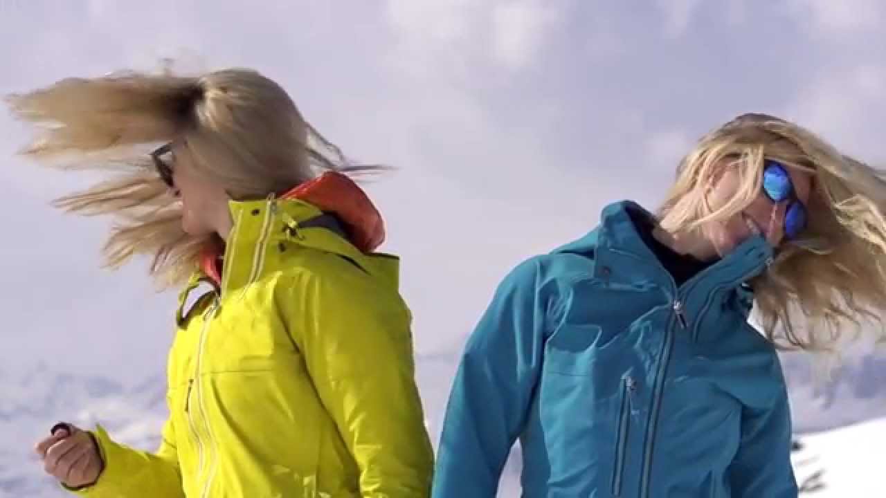
Are you dreaming of this too? The wide expanse of natural mountain world lies before you. You take a last deep breath. Then the descent starts through pristine powder, over high alpine territory with an altitude difference of up to 1000 metres. The greatest fun! Pure adrenaline!

In Osttirol all the routs can be accessed conveniently by lift and offer top-class experiences in fabulously untouched areas.

The insider tip is the 6km stretch from Bruggeralm in the St. Jakob ski resort.

youtube video

Basic safety guidelines

Backcountry skiing harbours many risks alongside unique beauty. Adhere therefore to the basic rules so as not to endanger others and yourselves unnecessarily:

  • Never ski off-piste alone!
  • Always carry safety equipment (VS device, spade, probe)!
  • Train your handling of safety equipment
  • Check the functioning of your VS device before starting any tour!
  • Check the current avalanche warnings and weather report!
  • Pay attention to noises in the snow blanket
  • Do not follow other trails if you do not know the territory!
  • Always maintain a safety distance of at least 25 metres
  • If you are in a group, only gather at safe places
  • Keep an eye on other skiers or snowboarders around you!
  • Never cross the slope ahead of others!

Freeriding at the ski centre St. Jakob i.D.

Freeride stretch Bruggeralm with 10 descent options

Ride up with the Almspitz lift to 2520 metres. Short hike (25 mins.) to the Lepplekofellenke at about 2660 metres (hides are advantageous), where a wonderful panorama towards the Villgraten mountains stretches to the south, with wide slopes inviting you to freeride.

The first turns head in a southerly direction – after a descent of around 250 altitude metres, you continue to the south-east to Bübenbiehl and over gently inclined slopes into the tranquil Bruggeralmtal. You head through it to the left of the stream and pass the rustic mountain village Bruggeralm. Then you can cross the stream over a bridge and head towards Eggenalm, from where a piste leads back to the valley descent and into the ski resort.


Altitude of starting point: 2520 m or 2660 m

Altitude of finish: 1700 m

Length of route in open territory: approx. 6 km

Freeriding at the ski centre Großglockner Resort Kals-Matrei

Kals-Matreier-Törl

Ausgehend von der Adlerlounge geht es über die Piste Nr. 13 bis zum Steilhang, wo die eigentliche Tour beginnt. Im freiem Gelände geht es geradeaus in Richtung Kals-Matreier Törl. Unterhalb des Törls eröffnet sich ein langgezogener Tiefschneehang, der keine Wünsche offen lässt. Das Ende der Tour bildet die Rückkehr zur Kalser Bergbahn.


Höhe Start: 2256 m

Höhe Ziel: 2030 m

Länge der Strecke im freien Gelände: ca. 900 m


Landen

Die Tour führt unterhalb der Matreier Goldried Bergbahn entlang. Nach einer kurzen Fahrt erreicht man eine herrliche Piste. Hier muss man sich rechts in Richtung Piste Nr. 4 halten. Außer dieser Piste gibt es weitere tolle Möglichkeiten, die Fahrt fortzusetzen. Dies geschieht über die Piste Nr. 3.


Höhe Start: 2161 m

Höhe Ziel: 1826 m

Länge der Strecke im freien Gelände: ca. 1400 m

Freeriding at the ski centre Hochpustertal

Thurntaler summit – Innervillgraten village centre

Ascend conveniently with the new heated 6-seater chairlift to 2400 metres. A breathtaking view of the Villgraten mountains, the Carnic ridge and the Sextner Dolomites. Descent through snowy slopes and meadows into the natural Villgraten valley. Lower part in a forested area.


Descent: approx. 30 mins.

Altitude metres: 3000 m


General note:

On the lower part of the descent, the partly steep and narrow trail should not be underestimated in difficult conditions! The descent ends at Klamperplatz. The return by bus to the valley station is free with a valid ski pass.

Freeriding at the ski centre Obertilliach-Golzentipp

Obertilliach – Jochsee

After ascending with the ultra-modern cable car and the Glamplift, exit to the left and right next to the wooden fence follow the mostly trodden very flat path with brief, easy climbs to the chalets of the Kutteschupfen. The trodden path continues to the Golzentripp. Just before the chalets, you already depart to the left and shortly afterwards reach the start of a ditch. To the right you continue past a dilapidated chalet to a beautiful ridge as far as a distinctive single wooden chalet on a ledge (approx. 2080 m). Behind it you descend the next 200 altitude metres steeply over treeless slopes until you reach sparse mountain forest in flatter territory (approx. 1900 m).

Here one keeps somewhat to the right to reach a treeless, very beautiful basin that leads back to the ski resort to the left. In the lower part, a stream cuts in relatively deeply, whereby one can set off to the left and right of it. In the area of the Stubenlift there are various possibilities to cross the stream.


Altitude of starting point: 2220 m

Altitude of finish: 1434 m

Length of route in open territory: approx. 3670 m

Detailed tour description


Obertilliach – Windischtal

After ascending with the ultra-modern cable car and the Glamplift, exit to the right and in front of the fence (approx. 2250 m) go to the north into the beautiful Trogtal. Before reaching the valley floor at around 200 m, one should keep to the right (east) of the basin to cross the entire west slopes of Laba. You then reach at about 1900 m the already mentioned forest road that you follow to the right. It leads, partly very flat, twice gently climbing, through the steep north slopes of Laba. After a game feeding station (approx. 1860 m) you can take a short-cut serpentine through sparse forest before arriving back on the forest road that you follow further to the south. Gently climbing, you go through a deeply incised basin in a big right curve (approx. 1760 m) before descending with a pleasant gradient. At last you reach a sledge run and in a bend the valley downhill slope no. 9 which takes you conveniently to the valley station of the chairlift.


Altitude of starting point: 2214 m

Altitude of finish: 1434 m

Length of route in open territory: approx. 7 km

Detailed tour description


 Source: freeskiers.net / Roland Wasmayer

You may also be interested in

Familienskigebiet Golzentipp - Obertilliach
Obertilliach Golzentipp
Skifahren Dorfberg
Skiing area Kartitsch
Newsletter

Subscribe to our newsletter and receive the best tips every month for current offers, mountain tours, events and much more.