Via ferrata "Türml" 2.845m

The most important at a glance

difficulty
🞽
C
length
100 m
duration
30 min
exposition
🔋
N
sea level starting point
🔋
2121 m
sea level entry point
🔋
2790 m
sea level highest point
🔋
2845 m
access time to the entry point
2:30 h
walking time descent
3 h
state: closed
best season:
JUN, JUL, AUG, SEP
access:
Von der Johannishütte über den Zettalunitzbach und den Dorferbach.Den felsigen Aderkamm umgeht man rechts und steigt in westlicher Richtung zum Türmjoch auf. Der Anstieg ist mit Steinmännern markiert. Abstieg: Entweder über den Ausfstieg oder über den Normalweg (A).
descent:
über den Normalweg (A) oder über den Aufstieg

arrival

Car park
Car park Hinterbichl 1.380m

altitude profile

Pdf file

Gpx file

Interactive map

Current weather conditions

Sonne-04.png
4°C/39°F °C

Description

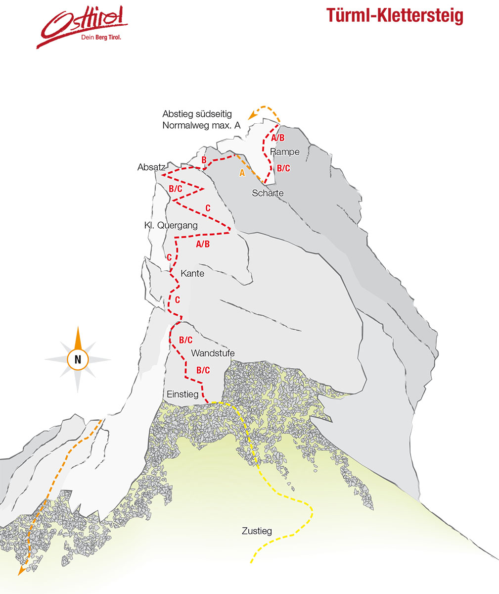
A fantastic view to the ice giants of the Venediger massif awaits at the end of this short, yet punchy via ferrata route to the Türml. From the start area at 2790m, the path (C) which is secured with steel cables throughout proceeds via steep slabs and exposed ridge areas up to the summit  – absolute climbing fun in high alpine terrain!


Difficult sections: C. The via ferrata route is part of a high alpine mountain tour. The weather can change very quickly here (check your equipment!).

Topos


Newsletter

Subscribe to our newsletter and receive the best tips every month for current offers, mountain tours, events and much more.