Faschingalm- Debanttal- Lienzer Hütte No. 107

The most important at a glance

distance
37.6 km
altitude meters uphill
🔋
1580 m
altitude meters downhill
🔋
1405 m
highest point
🞍
1975 m
difficulty
🞽
average
circuit
🞍
no
fitness:
* * * * *
🞙🞙🞙🞙🞙
technique:
* * * * *
🞙🞙🞙🞙🞙
parking:

Car park Zettersfeldbahn in Gaimberg.

starting point:
Nussdorf-Debant-Faschingalmparkplatz (1560m)
destination point:
Lienzer Hütte (1975m)
best season:
MAY, JUN, JUL, AUG, SEP, OCT

arrival

Car park
Car park Zettersfeldstraße
Car park Faschingalm

hut/alpine hut

altitude profile

Pdf file

Gpx file

Interactive map

Current weather conditions

Sonne-05.png
7°C/45°F °C

Description

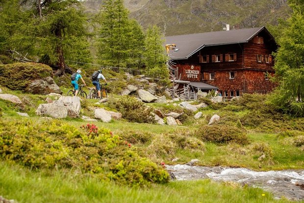
From the parking area of Zettersfeld Talstation the way over Obergaimberg leads on the same route as the 'Zettersfeldrunde 104' on the "Faschingalmstraße" to just below the pasture "Faschingalm". From there, the tour leads initially from flat to slightly until to the crossing of the road at the bridgte "Nussdorfer Brücke" (connection to the MTB route 153 Debanttal), and continues constantly upwards, crossing the border of the Hohe Tauern National Park at the car park "Seichenbrunn", always with a view on the charming landscape of the Hochschober to the Lienzer hut. On the way back you can go via the MTB Route 153 into the Debanttal valley to Nussdorf-Debant or on the MTB route Brandweg 149 to Iselsberg.
 

Newsletter

Subscribe to our newsletter and receive the best tips every month for current offers, mountain tours, events and much more.