Isel slope Prägraten - Hinterbichl

The most important at a glance

distance
6.9 km
snowed
no
difficulty
🞽
average
start altitude
...🔋
1300 m
destination altitude
🞍
1300 m
altitude meters uphill
🔋
102 m
highest point
🞍
1359 m
special accommodation for cross country skier
🅇
no
barrier-free
🅃
no
biathlon
🅔
no
cross country seal of quality
yes
state
closed
fitness:
* * * * *
🞙🞙🞙🞙🞙
technique:
* * * * *
🞙🞙🞙🞙🞙
best season:
JAN, FEB, MAR, DEC

arrival

Car park
Car park Freizeitzentrum Gries 1.300m

altitude profile

Pdf file

Gpx file

Interactive map

Current weather conditions

Sonne-04.png
18°C/64°F °C

Description

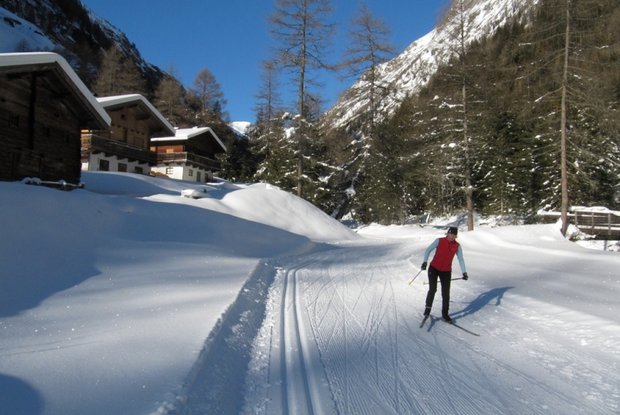
The "Isel slope" lives up to its name. It proceeds along the entire length of the left and right sides of the River Isel. With wonderful surrounding scenery, you are accompanied by the constant sound of the mountain river and the hoar frost which sticks to the trees and branches provides a unique view. After the start at the leisure centre, the slope proceeds to Unterfeld and from there climbs slightly, passing the hamlet of Hinterbichl. After a short section of descent you cross the River Isel and continue via Toinig bridge to the Toinig loop. The return section proceeds to Unterfeld, back on the same route. From there, continue to the starting point at the leisure centre.

Newsletter

Subscribe to our newsletter and receive the best tips every month for current offers, mountain tours, events and much more.