Hiking in the Villgratental

Mountain adventure for the whole family.

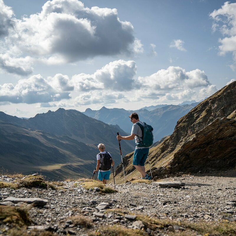
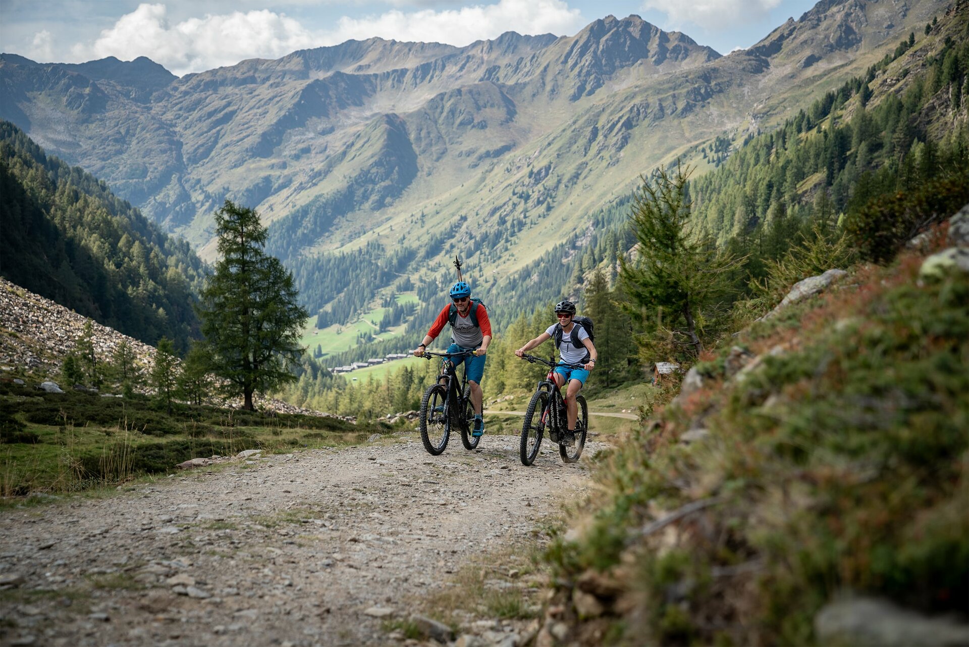
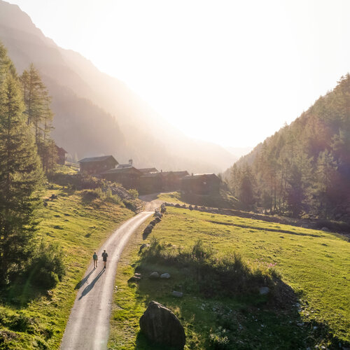
The Villgratental is a real paradise for hiking enthusiasts of all kinds. Whether leisurely walks on informative themed trails that offer exciting insights into the nature, history and culture of the region, or more challenging hikes at various levels of difficulty - everyone will find the right tour here. For those who like to spend several days out and about, the valley offers a wide range of options for long-distance hikes, turning miles-long stages into impressive experiences. The combination of bike & hike is particularly varied: if you cycle to remote starting points, you can explore the surrounding peaks and hiking trails even more easily and flexibly. The Villgratental thus offers a wide range of active outdoor experiences that will delight nature lovers, families and adventurers alike.


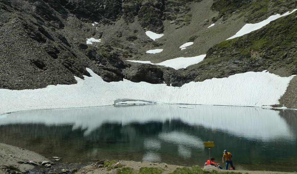
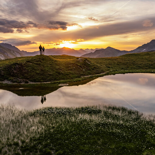
The Villgrat mountains, whose highest peaks reach almost 3,000 meters , offer you cultural trails close to the village, easy tours for families as well as challenging tours for experienced mountaineers. Let's go on a mountain adventure in the Villgratental!

back
Next
Eine Panoramaaufnahme von einem Sonnenaufgang in den Villgrater Bergen
Ein Wanderer auf dem Gipfel des Regenstein in Außervillgraten
Schrentebach Wasserfall
Herz-Ass Villgratental

Theme trails

state: open

Themed path "Smuggler’s path"

starting point:
Kalksteinq
destination point:
St. Magdalena / Gsiesertal
total walking time
5 h
distance
7 km
🔋
altitude meters uphill
800 hm
🞽
difficulty
average

Bonner Höhenweg

starting point:
Thurntaler
destination point:
St. Jakob i.D.
highest point:
2800 m
distance
38.9 km
🔋
altitude meters uphill
2560 hm
🞽
difficulty
average

Hikes

easy hikes

Around the Thurntaler

starting point:
Mountain rescue hut cable railway Thurntaler
destination point:
Mountain rescue hut cable railway Thurntaler
highest point:
509 m
total walking time
3:30 h
distance
9.8 km
🔋
altitude meters uphill
460 hm
🞽
difficulty
easy

Volkzeiner Hütte

starting point:
Reiterstube im Winkeltal
destination point:
Volkzeinerhütte
highest point:
1886 m
total walking time
3:30 h
distance
13.4 km
🔋
altitude meters uphill
370 hm
🞽
difficulty
easy

Oberstalleralm

starting point:
Parkplatz Jausenstation Unterstalleralm
destination point:
Oberstalleralm
highest point:
1864 m
total walking time
50 min
distance
2.8 km
🔋
altitude meters uphill
170 hm
🞽
difficulty
easy

moderately difficult hikes

Lake Schwarzsee

starting point:
Jausenstation Unterstalleralm
destination point:
Jausenstation Unterstalleralm
highest point:
2453 m
total walking time
3:30 h
distance
7.8 km
🔋
altitude meters uphill
790 hm
🞽
difficulty
average

Oberweg der Herz-Ass Villgratental

starting point:
Dorfzentrum Innervillgraten
destination point:
Reiterstbe Außervillgraten
highest point:
1812 m
total walking time
4 h
distance
11 km
🔋
altitude meters uphill
460 hm
🞽
difficulty
average

Marchkinkele

starting point:
Kalkstein
destination point:
Marchkinkele
highest point:
2545 m
total walking time
4 h
distance
9.2 km
🔋
altitude meters uphill
900 hm
🞽
difficulty
average

Kreuzspitze 2,624 m

starting point:
Innervillgraten, Kalkstein
destination point:
Kreuzspitze
highest point:
2591 m
total walking time
4:30 h
distance
10.5 km
🔋
altitude meters uphill
980 hm
🞽
difficulty
average

Toblacher Pfannhorn

starting point:
Innervillgraten, Kalkstein
destination point:
Toblacher Pfannhorn
highest point:
2650 m
total walking time
4:30 h
distance
9.8 km
🔋
altitude meters uphill
1020 hm
🞽
difficulty
average

Rote Spitze 2,956 m

starting point:
Parkplatz Jausenstation Unterstalleralm
destination point:
Rote Spitze
highest point:
2919 m
total walking time
5:30 h
distance
10.2 km
🔋
altitude meters uphill
1260 hm
🞽
difficulty
average

Hochgrabe 2,951m

starting point:
Parkplatz Volkzeinerhütte
destination point:
Hochgrabe
highest point:
2925 m
total walking time
6:30 h
distance
11.2 km
🔋
altitude meters uphill
1080 hm
🞽
difficulty
average

Königsweg der Herz-Ass Villgratental

starting point:
Dorfzentrum Innervillgraten
destination point:
Volkzeiner Hütte
highest point:
2946 m
total walking time
7 h
distance
14.7 km
🔋
altitude meters uphill
1560 hm
🞽
difficulty
average

difficult hikes

Rotes Kinkele

starting point:
Dorfzentrum Innervillgraten
destination point:
Rotes Kinkele
highest point:
2730 m
total walking time
6 h
distance
13 km
🔋
altitude meters uphill
1360 hm
🞽
difficulty
difficult

Gr. Degenhorn

starting point:
Volkzeiner Hütte
destination point:
Gr. Degenhorn
highest point:
2920 m
total walking time
6:30 h
distance
13 km
🔋
altitude meters uphill
1130 hm
🞽
difficulty
difficult

Weiße Spitze 2,962

starting point:
Parkplatz Jausenstation Unterstalleralm
destination point:
Weiße Spitze
highest point:
2935 m
total walking time
7 h
distance
9.3 km
🔋
altitude meters uphill
1260 hm
🞽
difficulty
difficult

Long distance hiking

Long-distance hiking is more than just walking - it is a journey to yourself. Day after day, new paths, encounters and views open up. Every step takes you further away from everyday life and closer to special moments that will stay with you for a long time. Whether gentle stages or challenging routes - the goal is always the same: to feel freedom, clear your head and enjoy being on the move.

Herz-Ass-Villgratental

In five stages, modeled on the original ascent, the Heart of Assisi connects the...

Bike & Hike

First pedal, then lace up your hiking boots - Bike & Hike combines cycling and hiking to create a varied nature experience. By bike, you can reach starting points that would often be difficult to access on foot. This is where the second part of the tour begins: the ascent to panoramic peaks or special destinations. This combination saves time, opens up new routes and makes the day more varied.


Experience more, get further, be more active - all in one tour.

Stories about hiking

This might also interest you

Majestätischer Sommerblick aus dem Tal auf die Burg Heinfels, eingebettet in grüne Laubbäume im satten Sommerkleid
Sights and excursion destinations

Osttirol offers a wide range of interesting excursion destinations and sights. The range extends from...

Newsletter

Subscribe to our newsletter and receive the best tips every month for current offers, mountain tours, events and much more.