Hiking in Obertilliach

The most beautiful hikes around the mountaineering village

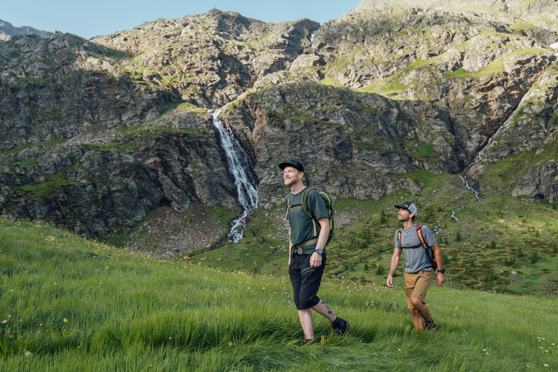
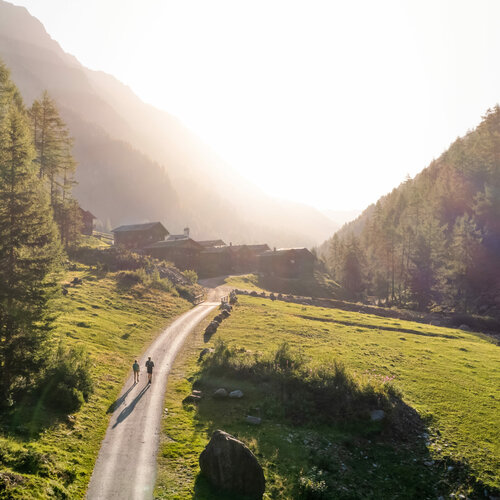
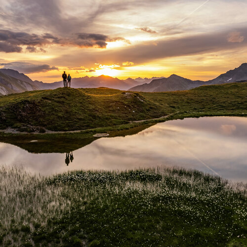
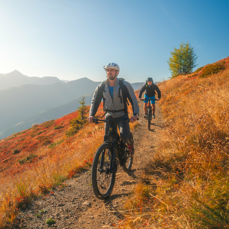
Leisurely footpaths lead directly from the village out into the idyllic landscape - perfect for relaxing hours in the clear mountain air. Those who prefer something a little more sporty will find a variety of hikes around Obertilliach with fantastic views and hidden power spots. Bike & Hike is particularly popular with active people: cycle along picturesque routes to the starting point and from there continue on foot to impressive peaks or tranquil Alpine pastures. Bike & Climb also offers variety and adventure for ambitious mountain sports enthusiasts who want to reach their destination on two wheels and with climbing equipment.


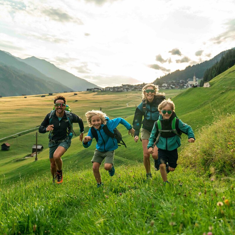
A special highlight are the long-distance hiking trails that lead through the region and combine sporting challenges with cultural insights. Anyone planning a family hike will find ideal conditions in Obertilliach: easy paths, lots of nature to discover and plenty of space for breaks and adventures. Hiking trails suitable for baby carriages ensure that even the youngest adventurers and explorers can explore nature. This makes hiking a relaxed experience for little adventurers, big nature lovers and everyone who wants to enjoy time together in the mountains.

back
Next
Wanderin mit gelbem Rucksack auf einer Lichtung in morgendlicher Stimmung kurz vor einem kleinen Gebirgsbach. Im Hintergrund strahlt die Morgensonne schon einen Bergrücken an.
Ein Paar mit Rucksäcken genießt die Aussicht am Bösen Weibele. Die Frau zeigt dem Mann etwas in der Ferne.
Ein Paar macht eine Pause auf einer Wiese mit Almrosen auf dem Weg zum Bösen Weibele zu einer Sonnenaufgangstour.
Etappe 9 - Oberes Leitertal
Etappe 5 - Marchkinkele Bergpanorama
Pfannspitze

Due to its geographical location, Obertilliach is influenced by the Mediterranean climate - perfect for a relaxing summer vacation. The high valley of Obertilliach is one of the most impressive landscapes in Europe - a distinction that has been recognized not only by the International Friends of Nature with the title "Landscape of the Year", but also by the European press as "Europe's most environmentally friendly valley". These accolades underline the village's commitment to nature-oriented and sustainable tourism, which is also reflected in its membership of the "Austrian Mountaineering Villages".

Obertilliacher mountain railroads

Where the mountains whisper stories and everyday life stays in the valley, the Obertilliacher Bergbahnen will take you on a new adventure.


Discover the Golzentipp hiking area now!

Footpaths

Circular hike via the Scharwiese high trail

starting point:
Talstation Golzentippbahn
destination point:
Talstation Golzentippbahn
total walking time
2 h
distance
5 km
🔋
altitude meters uphill
251 hm
🞽
difficulty
average
state: open

Rundwanderweg Biathlonzentrum

starting point:
Dorf Obertilliach
destination point:
Dorf Obertilliach
highest point:
1442 m
total walking time
1:20 h
distance
5.4 km
🔋
altitude meters uphill
100 hm
🞽
difficulty
easy

Rohnwaldrunde

starting point:
Dorf Obertilliach
destination point:
Dorf Obertilliach
highest point:
1460 m
total walking time
2:30 h
distance
9.3 km
🔋
altitude meters uphill
270 hm
🞽
difficulty
easy

Ralsrunde

starting point:
Tourismusbüro (Gemeindehaus)
destination point:
Gästehaus Unterwöger
highest point:
1449 m
total walking time
1:45 h
distance
5.9 km
🔋
altitude meters uphill
193 hm
🞽
difficulty
easy

Circular hiking trail via Kirchensteig to the biathlon center and back across the meadows

starting point:
Obertilliach Village
destination point:
Hotel Weiler, Obertilliach
highest point:
1511 m
total walking time
1:30 h
distance
4.3 km
🔋
altitude meters uphill
60 hm
🞽
difficulty
average

Hikes

easy hikes

Pleasure hike to Golzentipp

starting point:
Cable railway mountain hut
destination point:
Golzentipp
highest point:
2317 m
total walking time
2 h
distance
5.6 km
🔋
altitude meters uphill
267 hm
🞽
difficulty
easy

Porzehütte

starting point:
Bushaltestelle beim Hotel Weiler
destination point:
Porzehütte
highest point:
1930 m
total walking time
1 h
distance
1.5 km
🔋
altitude meters uphill
250 hm
🞽
difficulty
average
state: open

Kircher Alm

starting point:
Untertilliach
destination point:
Untertilliach
highest point:
2040 m
total walking time
4 h
distance
11.5 km
🔋
altitude meters uphill
830 hm
🞽
difficulty
easy

Steinrastl 2184 m

starting point:
Bergen/Flatsch
destination point:
Steinrastl
highest point:
2184 m
total walking time
4:30 h
distance
6.5 km
🔋
altitude meters uphill
710 hm
🞽
difficulty
easy

moderately difficult hikes

Hoher Bösring 2,324 m

starting point:
Biathlonzentrum Obertilliach
destination point:
Hoher Bösring
highest point:
2324 m
total walking time
3 h
distance
6.4 km
🔋
altitude meters uphill
940 hm
🞽
difficulty
average

Filmoor-Standschützenhütte über das Leitertal

starting point:
Leiten/Prünste
destination point:
Filmoor Standschützenhütte
highest point:
2346 m
total walking time
5:30 h
distance
8.5 km
🔋
altitude meters uphill
900 hm
🞽
difficulty
average

Porzehütte

starting point:
Bushaltestelle beim Hotel Weiler
destination point:
Porzehütte
highest point:
1930 m
total walking time
1 h
distance
1.5 km
🔋
altitude meters uphill
250 hm
🞽
difficulty
average

Golzentipp über Gripp (Nr. 47)

starting point:
Tourismusbüro Obertilliach
destination point:
Golzentipp Gipfel
highest point:
2317 m
total walking time
2:30 h
distance
5.6 km
🔋
altitude meters uphill
860 hm
🞽
difficulty
average

difficult hikes

state: closed

Porze über Klettersteig

starting point:
Klapfsee
destination point:
Porze
highest point:
2589 m
total walking time
5 h
🔋
altitude meters uphill
900 hm
🞽
difficulty
difficult

Eggenkofel Hauptgipfel

highest point:
2591 m
distance
5.8 km
🔋
altitude meters uphill
1040 hm
🞽
difficulty
difficult

Hochspitz 2,581 m

starting point:
Soldhäuser Untertilliach/Winkl
destination point:
Hochspitz
highest point:
2581 m
total walking time
7 h
distance
8.8 km
🔋
altitude meters uphill
1350 hm
🞽
difficulty
difficult

Große Kinigat

starting point:
Parking lot Rauchenbach/Kartitsch
destination point:
Gr. Kinigat
highest point:
2567 m
distance
8.5 km
🔋
altitude meters uphill
1250 hm
🞽
difficulty
difficult

Long distance hiking

When one day of hiking turns into several, the real journey begins. In Obertilliach, long-distance hiking takes you over gentle heights, through ancient cultural landscapes and across state and national borders. With light luggage and an open mind, every day becomes a new stage - and an invitation to experience the mountains at your own pace.

Kriegsruine Karnischer Kamm
"Karnischer Höhenweg" trail

The "Karnischer Höhenweg" trail or "Friedensweg" (KHW 403) leads along the entire Carnic ridge, which runs along the border between...

Höfe Trail

The Höfe Trail is Austria's first long-distance hiking trail that is entirely tailored to the wishes of thefamily...

Etappe 3 - Wegweiser
High & mighty

The "Hoch und Heilig - Bergpilgerweg" tells pilgrims about creation and its wonders. About the diversity of living nature and the original...

Sonnenaufgang auf den Glampwiesen und der "Connyalm"
Der Gailtaler Höhenweg

In the south of the Lienzer Dolomiten and in the western wing of the Gailtal Alps, the Gailtaler Höhenweg leads through impressive...

Bike & Hike

If you like hiking and want to discover new trails, combining it with a bike is an exciting addition. On so-called Bike & Hike tours, the first part of the route is covered by bike - usually up to a hut, mountain pasture or the head of a valley - before continuing on foot up to higher altitudes. This form of touring not only saves time and energy, but also opens up completely new opportunities to reach more remote peaks and scenic highlights.

Stories about hiking

This might also interest you

Biking in Obertilliach

Cycling around Obertilliach lets you discover the original side of the Alps: on quiet paths and gentle climbs, you cycle through...

Majestätischer Sommerblick aus dem Tal auf die Burg Heinfels, eingebettet in grüne Laubbäume im satten Sommerkleid
Sights and excursion destinations

Osttirol offers a wide range of interesting excursion destinations and sights. The range extends from...

read more
Newsletter

Subscribe to our newsletter and receive the best tips every month for current offers, mountain tours, events and much more.