2TälerTrail

Border crossing long-distance hiking in the mountain lake paradise Defereggental

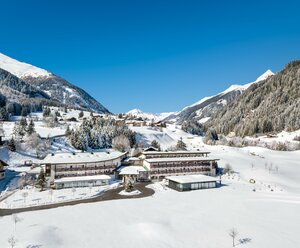
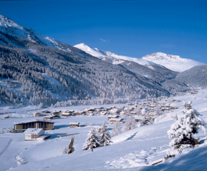
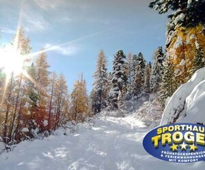
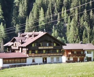
The boarder crossing "2TälerTrail" from Osttirol to Südtirol leads to ways where minings, varlets, church-goers and smugglers have walked ever since. This path is around 90 kilometres long and takes up to six days from Hopfgarten in Defereggen via St. Jakob in Defereggen and the Staller Sattel to Rasen in the Antholzertal-valley. The "2TälerTrail" is consciously no high alpine long-distance-hiking-trail and also no monoton valley trail, it's just a trail inbetween. It leads along avarage levels, between high alpine terrain and the valley bottom. Alpine mountain scenarious and cultural landscapes are changing. The views to the snow covered peaks of the Lasörling-group, Villgarter-mountains and the Rieserverner-group are simply stunning. Figuratively speaking, neither does the hiker walk on the roof nor on the ground floor but on the balcony of the alps. Choose your night stop in a village in one of the loveley hotels, guesthouses with halfboard or private rooms with breakfast after a superior hiking day.

not to the first floor, but on the balcony of the Alps. At the end of each day's stage is always reached a place where, depending on your choice, you can spend the night in a guesthouse, inn or hotel.

back
Next
The Obersee at the Staller Sattel
a welcome cooling in the mountain water paradise Defereggental
The balconies on the 2TälerTrail
promising resting places
Rustic farmhouses
Rustic farmhouses
can still be found in the Defereggental valley
Lush alpine meadows
Lush alpine meadows
a feast for the eyes from spring to autumn

2TälerTrail

starting point:
Hopfgarten im Defereggental
destination point:
Olang / Südtirol
highest point:
2383 m
total walking time
34 h
distance
92 km
🔋
altitude meters uphill
5528 hm
🞽
difficulty
average

The stages of the 2 TälerTrail

The long-distance trail can be walked in 6 stages. However, the structure can be individually and differently. We are happy to help you with your personal tour planning.

state: closed

2TälerTrail - Stage 1: From Hopfgarten to St. Veit

starting point:
Hopfgarten in Defereggen
destination point:
St. Veit in Defereggen
highest point:
2000 m
total walking time
8 h
distance
19.7 km
🔋
altitude meters uphill
1438 hm
🞽
difficulty
average

2TälerTrail - Stage 2: From St. Veit to St. Jakob

starting point:
St. Veit in Defereggen - Dorfplatz
destination point:
St. Jakob in Defereggen
highest point:
2500 m
total walking time
6 h
distance
13.7 km
🔋
altitude meters uphill
1040 hm
🞽
difficulty
average

2TälerTrail - Stage 3: From St. Jacob to Maria Hilf

starting point:
St. Jakob in Defereggen - Dorf
destination point:
St. Jakob in Defereggen - Maria Hilf
highest point:
2400 m
total walking time
6 h
distance
14.8 km
🔋
altitude meters uphill
1100 hm
🞽
difficulty
average

2TälerTrail - Stage 4: From Maria Hilf to Lake Antholz

starting point:
St. Jakob in Defereggen - Maria Hilf
destination point:
Antholzersee
highest point:
2100 m
total walking time
6 h
distance
15.9 km
🔋
altitude meters uphill
1100 hm
🞽
difficulty
average

2TälerTrail - Stage 5: From Lake Antholz to Antholz Mittertal

starting point:
Antholzer See - Südtirol
destination point:
Antholz-Mittertal - Südtirol
highest point:
1800 m
total walking time
5 h
distance
15 km
🔋
altitude meters uphill
773 hm
🞽
difficulty
average

2TälerTrail - Stage 6: From Antholz-Mittertal to Niederrasen

starting point:
Antholz-Mittertal - Südtirol
destination point:
Niederrasen - Südtirol
highest point:
1300 m
total walking time
3 h
distance
13.3 km
🔋
altitude meters uphill
193 hm
🞽
difficulty
easy

Overnight stay on the 2TälerTrail

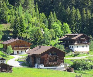
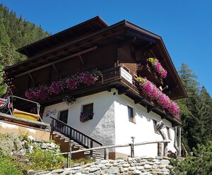
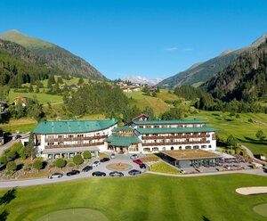
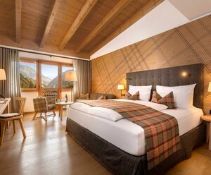
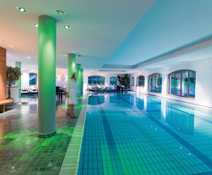
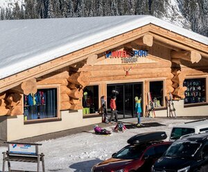
The 2TälerTrail offers many accommodation options. From simple rooms in private accommodations, to modern, spacious rooms in private accommodations or hotels - the suitable accommodation is available for every requirement. Here you can find the vacation specialists at the 2TälerTrail:

Additional refreshment stops at mountain huts

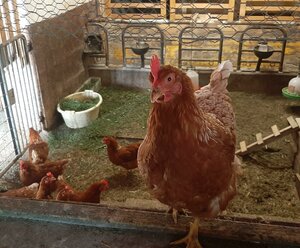
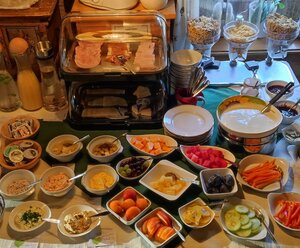
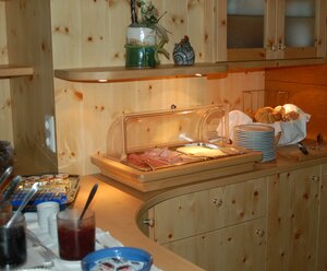
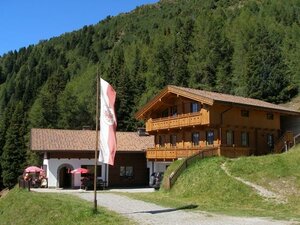
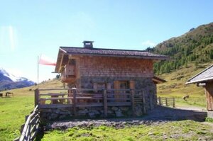
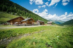
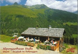
The huts and alpine pastures along the way offer a wide range of regional, often homemade products, which are processed into typical Tyrolean dishes.

infrastructure.name
open today
Alpe Stalle 1.714m
9963 Sankt Jakob in Defereggen
infrastructure.name
open today
Alpengasthaus Obersee 2.020m
infrastructure.name
Jausenstation Speikbodenhütte 2.050m
infrastructure.name
Stalleralm - Hinterpasslerhütte 1.955m
Guided mountain tours

The mountain guides in Osttirol are the professionals when it comes to a safe, eventful tour to one of the numerous peaks.


Your way to the summit experience

More information

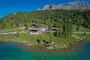
There are regular opportunities for access and descent.

Many accomodations offer luggage transport on the 2TälerTrail.


Timetable bus line 953 - Defereggental: www.vvt.at
Current weather situation in East Tyrol: Osttirol weather
Current trail condition and information on trail closures: Contact the respective hut host or the tourist information.

Maps and brochures are available in every tourist information and can also be ordered.

You may also be interested in

Neue Reichenbergerhütte
Lasörling trek

3-day hike from Defereggental to Virgental valley

Talrundweg Kals - Rastplatz Schoberblick
Talrundweg Kals

Learn more about the Interreg project on the page of the Regional Management of Osttirol. This project is implemented in cooperation with the Tourism Association of East Tyrol and the Tourism Association of Antholz Valley and with the financial support of the European Union.

Newsletter

Subscribe to our newsletter and receive the best tips every month for current offers, mountain tours, events and much more.