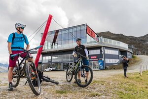
Travelling by bicycle in Osttirol

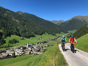
As well as being a paradise for hikers, climbers, skiers and ski mountaineers, Osttirol is also an insider’s tip for cyclists. They can enjoy a constantly expanding range of options, from challenging ascents and single trails for mountain bikers and quiet side roads for racing cyclists to more leisurely routes for long-distance cyclists, such as the Draur Cycle Route.


You can find cycle routes on the interactive map of the Osttirol tourism association, which also has an overview of charging stations for e-bikes. The Tyrol region’s interactive cycle tour map is another useful route planning tool.


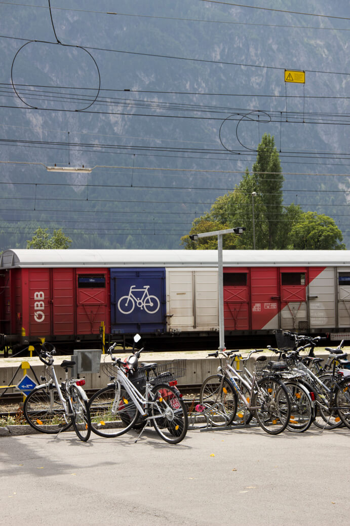
The Drau Cycle Route can be combined with the rail service, allowing you to cycle one way and make the return journey by train.

Cycle, mountain bike and e-bike routes

Let us show you the best routes

filter results
more filter otions
starting point:
Leisach-Schloß Bruck (725m)
destination point:
Leisach (712m)
distance
15.6 km
🔋
altitude meters uphill
833 hm
🞽
difficulty
average
starting point:
Obertilliach-Bundesstr. (1440m)
destination point:
Tilliacher Joch (2094m)
distance
10.3 km
🔋
altitude meters uphill
750 hm
🔋
altitude meters downhill
750 hm
🞽
difficulty
average
starting point:
Assling-Parkplatz Hochstein (680m)
destination point:
Parkplatz Hochstein (680m)
distance
31.1 km
🔋
altitude meters uphill
1390 hm
🞽
difficulty
difficult
starting point:
Nussdorf-Debant-Faschingalmparkplatz (1560m)
destination point:
Lienzer Hütte (1975m)
distance
37.6 km
🔋
altitude meters uphill
1580 hm
🔋
altitude meters downhill
1405 hm
🞽
difficulty
average
starting point:
Tessenberg/Fronstadl (1340m)
destination point:
Fronstadlalm (2030m)
distance
15.4 km
🔋
altitude meters uphill
790 hm
🔋
altitude meters downhill
690 hm
🞽
difficulty
average
starting point:
St. Oswald (Kartitsch) (1358m)
destination point:
Dorfberg (1965m)
distance
13.8 km
🔋
altitude meters uphill
600 hm
🔋
altitude meters downhill
600 hm
🞽
difficulty
average
starting point:
Assling-Sportzentrum Thal (800m)
destination point:
Sportzentrum Thal (800m)
distance
18.8 km
🔋
altitude meters uphill
850 hm
🞽
difficulty
average
starting point:
Leisach (712m)
destination point:
Sternalm (1505m)
distance
11 km
🔋
altitude meters uphill
760 hm
🞽
difficulty
average
starting point:
Kals am Großglockner-Ködnitz (1330m)
destination point:
Moaralm (1810m)
distance
10.9 km
🔋
altitude meters uphill
482 hm
🔋
altitude meters downhill
483 hm
🞽
difficulty
average
starting point:
Kals am Großglockner (1330m)
destination point:
Kals (1330m)
distance
12.8 km
🔋
altitude meters uphill
584 hm
🔋
altitude meters downhill
570 hm
🞽
difficulty
average
starting point:
Kals am Großglockner-Parkplatz Dorfertal (1500m)
destination point:
Pifangalm (2250m)
distance
18.2 km
🔋
altitude meters uphill
906 hm
🔋
altitude meters downhill
914 hm
🞽
difficulty
difficult
starting point:
Dölsach-Schwimmbad (650m)
destination point:
Ederplan (1190m)
distance
22 km
🔋
altitude meters uphill
1412 hm
🔋
altitude meters downhill
1412 hm
🞽
difficulty
difficult
starting point:
Virgen (Tratte) (1100m)
destination point:
Würfelehütte (1380m)
distance
4.3 km
🔋
altitude meters uphill
280 hm
🔋
altitude meters downhill
280 hm
🞽
difficulty
average
starting point:
Kals am Großglockner-Großdorf (1360m)
destination point:
Gornalm (1930m)
distance
11.4 km
🔋
altitude meters uphill
612 hm
🔋
altitude meters downhill
613 hm
🞽
difficulty
average
starting point:
Lienz, Abzw. Schloss Bruck (682m)
destination point:
Lienz, Abzw. Schloss Bruck (682m)
distance
40 km
🔋
altitude meters uphill
220 hm
🔋
altitude meters downhill
220 hm
🞽
difficulty
easy
starting point:
Nikolsdorf-Bahnhof (640m)
destination point:
Bahnhof Nikolsdorf (640m)
distance
28.5 km
🔋
altitude meters uphill
1150 hm
🞽
difficulty
average
state: closed
starting point:
Anras-Feuerwehrhaus Mittewald (900m)
destination point:
Linderkaser (1750m)
distance
10 km
🔋
altitude meters uphill
820 hm
🔋
altitude meters downhill
860 hm
🞽
difficulty
difficult
starting point:
Toblach
destination point:
Nikolsdorf
distance
63 km
🔋
altitude meters uphill
50 hm
🔋
altitude meters downhill
600 hm
🞽
difficulty
easy
starting point:
Prägraten-Hinterbichl (1335m)
destination point:
Johannishütte (2130m)
distance
16.1 km
🔋
altitude meters uphill
780 hm
🔋
altitude meters downhill
780 hm
🞽
difficulty
average
starting point:
St. Jakob im Defereggen-Kirchl "Maria Hilf" (1422m)
destination point:
Hintere Alpe Stalle (2046m)
distance
11.1 km
🔋
altitude meters uphill
570 hm
🔋
altitude meters downhill
570 hm
🞽
difficulty
average
starting point:
Heinfels-Tessenberg (1320m)
destination point:
Tessenberger Alm (1950m)
distance
5.3 km
🔋
altitude meters uphill
630 hm
🞽
difficulty
average
starting point:
Lienz (675m)
destination point:
Matrei (980m)
distance
53 km
🔋
altitude meters uphill
300 hm
🔋
altitude meters downhill
300 hm
🞽
difficulty
easy
starting point:
Hopfgarten im Defereggen-Blosbrücke (1102m)
destination point:
Bloshütte (1795m)
distance
13.8 km
🔋
altitude meters uphill
680 hm
🔋
altitude meters downhill
680 hm
🞽
difficulty
difficult
starting point:
Innervillgraten (1380m)
destination point:
Innervillgraten (1380m)
distance
24 km
🔋
altitude meters uphill
720 hm
🔋
altitude meters downhill
720 hm
🞽
difficulty
average
starting point:
Assling-Dorfplatz (1125m)
destination point:
Dorfplatz Assling (1125m)
distance
16.8 km
🔋
altitude meters uphill
835 hm
🞽
difficulty
average
starting point:
Nussdorf-Debant-Zettersfeldtalstation (725m)
destination point:
Zettersfeldtalstation (725m)
distance
22 km
🔋
altitude meters uphill
1165 hm
🞽
difficulty
average
starting point:
Assling-Dorfplatz (1125m)
destination point:
Dorfplatz Assling (1125m)
distance
15.6 km
🔋
altitude meters uphill
995 hm
🞽
difficulty
average
starting point:
Hopfgarten im Defereggen-Wasserhalle (998m)
destination point:
Parkplatz Gumplalm (1660m)
distance
11.6 km
🔋
altitude meters uphill
660 hm
🔋
altitude meters downhill
660 hm
🞽
difficulty
average
starting point:
Assling-Dorfplatz (1125m)
destination point:
Assling - Dorfplatz (1125m)
distance
38 km
🔋
altitude meters uphill
1530 hm
🔋
altitude meters downhill
1560 hm
🞽
difficulty
difficult
starting point:
Talstation Brunnalm Bergbahnen
destination point:
Brugger Alm Jausenstation
distance
7.7 km
🔋
altitude meters uphill
400 hm
🔋
altitude meters downhill
400 hm
🞽
difficulty
average
starting point:
Hintere Stalle
destination point:
Jesach Alm
distance
1.9 km
🔋
altitude meters uphill
60 hm
🔋
altitude meters downhill
60 hm
🞽
difficulty
average
starting point:
Eingang Trojer Tal
destination point:
Gasser Kofel
distance
9.9 km
🔋
altitude meters uphill
510 hm
🔋
altitude meters downhill
510 hm
🞽
difficulty
average
starting point:
Eingang Trojer Tal
destination point:
Almgebiet Tögischer Bachl
distance
9.3 km
🔋
altitude meters uphill
460 hm
🔋
altitude meters downhill
460 hm
🞽
difficulty
average
distance
29.5 km
🔋
altitude meters uphill
1300 hm
🞽
difficulty
difficult
starting point:
Sillian
destination point:
Sillia
distance
150 km
🔋
altitude meters uphill
1840 hm
🞽
difficulty
average
starting point:
Lienz
destination point:
Lienz
distance
180 km
🔋
altitude meters uphill
4700 hm
🔋
altitude meters downhill
2703 hm
🞽
difficulty
difficult
starting point:
Amlacher Straße in Lienz
destination point:
Lienz center
distance
112 km
🔋
altitude meters uphill
1870 hm
🞽
difficulty
average
starting point:
St. Jakob i. Def.
destination point:
Klammljock
distance
44 km
🔋
altitude meters uphill
890 hm
🞽
difficulty
average
starting point:
Lienz
destination point:
Lienz
distance
38 km
🔋
altitude meters uphill
1450 hm
🔋
altitude meters downhill
1400 hm
🞽
difficulty
average
starting point:
station Lienz
destination point:
station Lienz
distance
112 km
🔋
altitude meters uphill
5392 hm
🔋
altitude meters downhill
5396 hm
🞽
difficulty
difficult
starting point:
Lienz
destination point:
Lienz
distance
125 km
🔋
altitude meters uphill
850 hm
🞽
difficulty
average
starting point:
Bergbahn Mittelstation
destination point:
Kals am Großglockner
distance
2.3 km
🔋
altitude meters downhill
414 hm
🞽
difficulty
difficult
state: open
starting point:
Moosalm Lienz
destination point:
Hochstein Lienz
distance
2 km
🔋
altitude meters uphill
10 hm
🔋
altitude meters downhill
355 hm
🞽
difficulty
average
state: open
starting point:
cimaroß
destination point:
Mittelstation Bergbahn Kals
distance
3.7 km
🔋
altitude meters downhill
434 hm
🞽
difficulty
average
state: open
starting point:
sports ground, Sportplatz Tristach
destination point:
hut, Dolomitenhütte
distance
15 km
🔋
altitude meters uphill
935 hm
🔋
altitude meters downhill
935 hm
🞽
difficulty
average
starting point:
Lienz
destination point:
hut, Hochsteinhütte
distance
32 km
🔋
altitude meters uphill
1350 hm
🔋
altitude meters downhill
1350 hm
🞽
difficulty
average
starting point:
Temblerfelder
destination point:
Temblerhof
distance
0.6 km
🔋
altitude meters uphill
658 hm
🔋
altitude meters downhill
90 hm
🞽
difficulty
easy
state: open
starting point:
Adler Lounge
destination point:
Adler Lounge
distance
5.3 km
🔋
altitude meters uphill
248 hm
🔋
altitude meters downhill
252 hm
🞽
difficulty
average
starting point:
Goldried Bergbahnen
destination point:
Berggasthaus Goldried
distance
24 km
🔋
altitude meters uphill
1270 hm
🔋
altitude meters downhill
1260 hm
🞽
difficulty
average
starting point:
Sportsarea Gries
destination point:
Timmeltal
distance
22.9 km
🔋
altitude meters uphill
1000 hm
🔋
altitude meters downhill
990 hm
🞽
difficulty
average
starting point:
Parking area cable car Kals
destination point:
Parking area cable car Kals
distance
4.9 km
🔋
altitude meters uphill
156 hm
🔋
altitude meters downhill
153 hm
🞽
difficulty
average
starting point:
Parking area cable car Kals
destination point:
Parking area cable car Kals
distance
7.5 km
🔋
altitude meters uphill
115 hm
🔋
altitude meters downhill
109 hm
🞽
difficulty
easy
starting point:
Parking area cable car Kals
destination point:
Kerer Alm
distance
10.3 km
🔋
altitude meters uphill
493 hm
🔋
altitude meters downhill
495 hm
🞽
difficulty
average
destination point:
Lesachalm
distance
13.2 km
🔋
altitude meters uphill
654 hm
🔋
altitude meters downhill
655 hm
🞽
difficulty
average
starting point:
Parkplatz bei der Matreier Goldried Bergbahn
destination point:
Umbalfälle
distance
48.2 km
🔋
altitude meters uphill
1090 hm
🔋
altitude meters downhill
1090 hm
🞽
difficulty
average
starting point:
Sports area Gries
destination point:
Stabanthütte
distance
10.3 km
🔋
altitude meters uphill
500 hm
🔋
altitude meters downhill
500 hm
🞽
difficulty
average
starting point:
Mittelstation der Gondelbahn (Gornermulde)
destination point:
Bergstation der Gondelbahn Kals
distance
1.8 km
🔋
altitude meters uphill
232 hm
🞽
difficulty
average
starting point:
Parkplatz Lucknerhaus
destination point:
Lucknerhütte
distance
5.5 km
🔋
altitude meters uphill
327 hm
🔋
altitude meters downhill
326 hm
🞽
difficulty
difficult
starting point:
Sternalm
destination point:
Moosalm
distance
5 km
🔋
altitude meters uphill
90 hm
🔋
altitude meters downhill
610 hm
🞽
difficulty
average
state: open
starting point:
Sternalm
destination point:
Moosalm
distance
0.635 km
🔋
altitude meters downhill
130 hm
🞽
difficulty
difficult
state: open
starting point:
Sports field Debant
destination point:
hut Lienzer Hütter
distance
35 km
🔋
altitude meters uphill
1300 hm
🔋
altitude meters downhill
1300 hm
🞽
difficulty
average
starting point:
Parkplatz Hochstein
destination point:
Lifthütte Moosalm
distance
5 km
🔋
altitude meters uphill
330 hm
🔋
altitude meters downhill
330 hm
🞽
difficulty
average
starting point:
Amlacher Straße in Lienz
destination point:
Lienz / center
distance
228 km
🔋
altitude meters uphill
5450 hm
🞽
difficulty
difficult
starting point:
MTB-Route Bodenalm - Timmeltal Nr. 129
destination point:
Aussichtsplatz Wuneck
distance
18.4 km
🔋
altitude meters uphill
920 hm
🔋
altitude meters downhill
920 hm
🞽
difficulty
average
starting point:
St. Jakob i. Defereggen
destination point:
Jausenstation Trojeralm
distance
9.3 km
🔋
altitude meters uphill
400 hm
🔋
altitude meters downhill
400 hm
🞽
difficulty
average
starting point:
Moosalm
destination point:
Schrankenanlage Stadtweg
distance
4 km
🔋
altitude meters uphill
60 hm
🔋
altitude meters downhill
340 hm
🞽
difficulty
easy
state: open
starting point:
Sportplatz Tristach
destination point:
Karlsbaderhütte
distance
26.2 km
🔋
altitude meters uphill
1590 hm
🔋
altitude meters downhill
1560 hm
🞽
difficulty
difficult
starting point:
Parking space Schöne Aussicht
destination point:
valley Debanttal
distance
6.8 km
🔋
altitude meters uphill
320 hm
🔋
altitude meters downhill
270 hm
🞽
difficulty
average
starting point:
Gasthof Schöne Aussicht
distance
13.6 km
🔋
altitude meters uphill
590 hm
🔋
altitude meters downhill
590 hm
🞽
difficulty
average
scroll for more

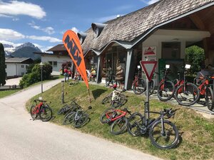
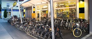
Bicycle and e-bike hire

You can rent the latest bikes at your destination.

infrastructure.name
Alpinsport Gratz
Großdorf 80
9981 Kals am Großglockner
infrastructure.name
Alpinsport Gratz/Gradonna
Gradonna 1
9981 Kals am Großglockner
infrastructure.name
E-Bike-Verleih "Bergankunft"
Iselsberg 172
9992 Iselsberg
infrastructure.name
E-Mountainbikeverleih Villgratental
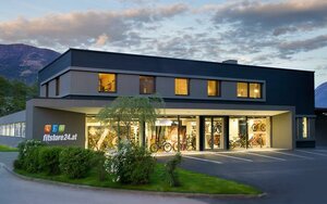
Gasse 93
9932 Innervillgraten
infrastructure.name
Fitstore24 ZANIER GmbH
Hermann Gmeiner Strasse 7
9990 Nußdorf-Debant
infrastructure.name
Radhaus
Europastraße 18
9971 Matrei in Osttirol
infrastructure.name
Radverleih Dolomitebike Hochstein
Iseltalerstraße 27
9900 Lienz Lienz
infrastructure.name
Radverleih Papin Sport
infrastructure.name
Radverleih Papin Sport
Bahnhofsgelände Sillian
9920 Sillian
infrastructure.name
Radverleih Pro Bike

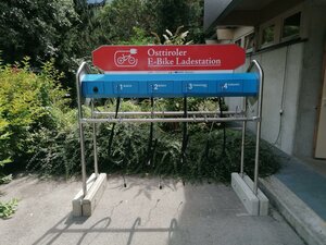
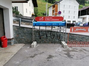
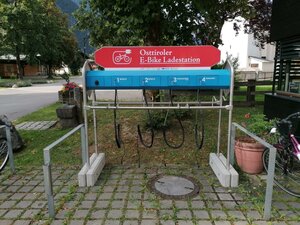
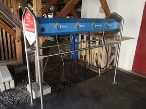
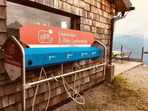
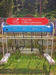
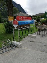
E-bike charging stations

infrastructure.name
E-Bike Ladestation Aguntum
Römerstraße 1
9991 Dölsach
infrastructure.name
E-Bike Ladestation Alpengasthof Pichler
Gsaritzen 13
9962 St. Veit in Defereggen
infrastructure.name
E-Bike Ladestation Alte Mühle
Gereitstraße 4
9971 Matrei in Osttirol
infrastructure.name
E-Bike Ladestation Amlach
Lindenstraße 4
9908 Amlach
infrastructure.name
E-Bike Ladestation Badl-Alm
Kalkstein 160a
9932 Innervillgraten
infrastructure.name
E-Bike Ladestation Berggasthaus Goldried
infrastructure.name
E-Bike Ladestation Cafè Gries
St. Andrä 42a
9974 Prägraten am Grossvenediger
infrastructure.name
E-Bike Ladestation Dolomitenhof
infrastructure.name
E-Bike Ladestation Dolomitenhütte
infrastructure.name
E-Bike Ladestation Dorfplatz Virgen
Virgental Straße 77
9972 Virgen

You may also be interested in

Bus in Winterlandschaft im Stubaital
Buses & trains

The map of scheduled services gives you an overview of all scheduled bus and train services in Osttirol.

Autosammeltaxi Osttirol
Dial-a-ride taxi service

The dial-a-ride taxi service uses the regular stops of the scheduled bus service or dial-a-ride collection points, but only on demand.