The Großglockner

Jewel of the Alps

At a height of 3,798 meters, the Grossglockner rises majestically as Austria's highest mountain. Truly regal, it sits enthroned in the heart of the impressive backdrop of the Nationalpark Hohe Tauern and is considered one of the most important peaks in the Eastern Alps. The striking, pyramid-shaped peak made of green slate rock rises proudly from the impressive alpine natural paradise.

As early as 1561, the Großglockner was referred to as the "Glocknerer" in a printed atlas. The most common explanation is derived from its bell shape. In 1583, it was first mentioned in a document in the description of the court of Kals, in which it is referred to twice as the Kals border mountain "Glogger".


A mountain of longing for many, a mountain of destiny for some

With over 5000 summit ascents per year, it is a popular destination for mountaineers. The view of the mountain, one of Austria's most famous landmarks, is the main scenic attraction of Kals am Großglockner. To reach the summit, you should be fit, absolutely free from vertigo, sure-footed and accompanied by a mountain guide.

Climbing history

The first ascent of the Grossglockner on July 28, 1800 was made by an expedition led by Prince-Bishop Franz Xaver Count Salm-Reifferscheid, Pastor Horrasch from Döllach and the Klotz brothers from the Carinthian side (Heiligenblut). The first ascent from Kals and thus from the Osttirol side was made in October 1855 by the mountain guides Georg Ranggetiner and Johann Huter.


A new era began for Kals with Johann Stüdl. He built the Stüdlhütte, the first mountain hut in the Eastern Alps. Kals became the center for climbing the Glockner. As early as 1869, the first mountain guide association in the Alps was founded on the initiative of Johann Stüdl. Under the chairmanship of Pastor Andreas Lercher, the Kals mountain guides were well organized with statutes and guide regulations and made a name for themselves far beyond the borders.


Johann Stüdl was called the "Glocknerherr" in Kals and was made an honorary citizen of the community in 1870. The largest tower bell in the parish church was christened in his name. Stüdl's commitment to Kals was priceless. Alpinism developed excellently, but came to a standstill at the beginning of the First World War. Since the end of the Second World War, the Grossglockner has played an important role in the development of alpinism.

The Grossglockner summit cross

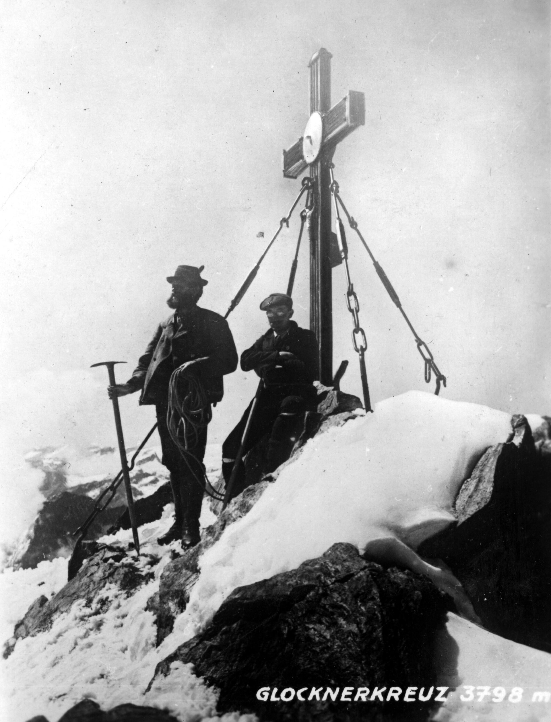
Since February 8, 2024, the summit cross of the Grossglockner, also known as the Emperor's Cross, dating from 1880 has been a listed monument and is therefore Austria's highest monument. It was erected from wood by four carpenters on July 29, 1800, the day after the first ascent. However, due to its exposure, the wooden cross fell into disrepair after a few years. The crosses on the Kleinglockner and Großglockner from 1799 and 1800 were among the first summit crosses in the modern sense, which were elaborately crafted specifically for erection on a summit.


On 2 October 1880, a three-metre high iron cross weighing 300 kg was erected on the summit of the Grossglockner by the mountain guides of Kals in honor of Emperor Franz Joseph I and Empress Elisabeth.


To mark the 200th anniversary of the first ascent, the cross was flown down to the valley in a heavy-lift helicopter and restored. The restoration of the 120-year-old Glockner cross in 1999 marked a high point in the historical development of the Kalser Berg- und Schiführerverein. During this time, a replacement cross was installed.

Ascent routes to the Großglockner

The main ascent begins at the Kalser Glocknerstraße parking lot at the Lucknerhaus (1,918 m) and leads through the Ködnitztal valley with its idyllic larch forests and wide alpine pastures to the Lucknerhütte (2,241 m). From here, the trail (AV no. 702 B) continues over the Viehböden (2,550 m) to the Stüdlhütte on the Fanotscharte (2,802 m). The Teischnitz valley offers another ascent option to the Stüdlhütte. At the Teischnitzbach bridge (1,620 m, just below the Moaalm), the path (AV no. 712) branches off to the right. Initially via a forest path to the plateau of the Teischnitz Valley (2,075 m), continuing via a narrow path to the Stüdlhütte. Scenic, but only recommended in safe weather and snow-free conditions.


Summer routes to the Großglockner (3,798 m), starting point Stüdlhütte:

  • Normal ascent via Erzherzog-Johann-Hütte (Adlersruhe) 3,454 m, approx. 4 hours
  • Stüdlgrat (south-west ridge) as an extension of the Luisengrat, approx. 4.5 hours
  • Northwest ridge via Untere Glocknerscharte - Teufelshorn 3,680 m - summit, approx. 5 - 6 hours
  • Glocknerwand 3,721 m - northwest ridge - summit, approx. 8 - 9 hours

This might also interest you

Das Bild zeigt die Obstansersee Hütte mit den Bergen im Hintergrund
Long-distance hiking in Osttirol

Embark on a journey on foot and explore the mountains and valleys of the Lienz district along various routes.

Nahaufnahme von einem Kletter-Sicherungsgerät, einem Seil und bunten Karabinern. Im Hintergrund stehen mehrere Personen.
Mountain guide - Safe on the mountain

Thanks to their extensive training, which is among the most highly qualified in all areas of alpinism, Osttirol's mountain and ski guides are valuable experts in many areas.