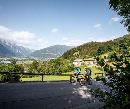
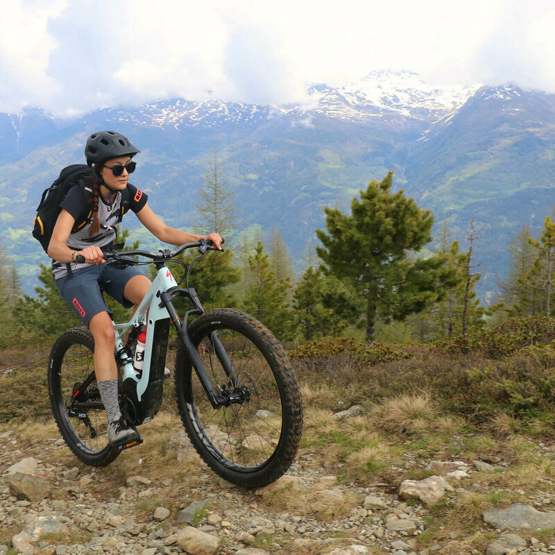
Mountainbike trails in Osttirol

filter results
more filter otions
starting point:
Leisach-Schloß Bruck (725m)
destination point:
Leisach (712m)
distance
15.6 km
🔋
altitude meters uphill
833 hm
🞽
difficulty
average
starting point:
Obertilliach-Bundesstr. (1440m)
destination point:
Tilliacher Joch (2094m)
distance
10.3 km
🔋
altitude meters uphill
750 hm
🔋
altitude meters downhill
750 hm
🞽
difficulty
average
starting point:
Assling-Parkplatz Hochstein (680m)
destination point:
Parkplatz Hochstein (680m)
distance
31.1 km
🔋
altitude meters uphill
1390 hm
🞽
difficulty
difficult
starting point:
Nussdorf-Debant-Faschingalmparkplatz (1560m)
destination point:
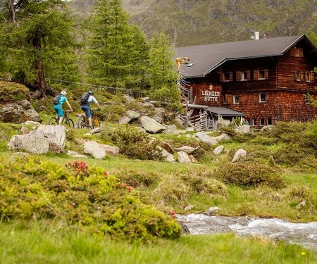
Lienzer Hütte (1975m)
distance
37.6 km
🔋
altitude meters uphill
1580 hm
🔋
altitude meters downhill
1405 hm
🞽
difficulty
average
starting point:
Tessenberg/Fronstadl (1340m)
destination point:
Fronstadlalm (2030m)
distance
15.4 km
🔋
altitude meters uphill
790 hm
🔋
altitude meters downhill
690 hm
🞽
difficulty
average
starting point:
St. Oswald (Kartitsch) (1358m)
destination point:
Dorfberg (1965m)
distance
13.8 km
🔋
altitude meters uphill
600 hm
🔋
altitude meters downhill
600 hm
🞽
difficulty
average
starting point:
Assling-Sportzentrum Thal (800m)
destination point:
Sportzentrum Thal (800m)
distance
18.8 km
🔋
altitude meters uphill
850 hm
🞽
difficulty
average
starting point:
Leisach (712m)
destination point:
Sternalm (1505m)
distance
11 km
🔋
altitude meters uphill
760 hm
🞽
difficulty
average
starting point:
Kals am Großglockner-Ködnitz (1330m)
destination point:
Moaralm (1810m)
distance
10.9 km
🔋
altitude meters uphill
482 hm
🔋
altitude meters downhill
483 hm
🞽
difficulty
average
starting point:
Kals am Großglockner (1330m)
destination point:
Kals (1330m)
distance
12.8 km
🔋
altitude meters uphill
584 hm
🔋
altitude meters downhill
570 hm
🞽
difficulty
average
starting point:
Kals am Großglockner-Parkplatz Dorfertal (1500m)
destination point:
Pifangalm (2250m)
distance
18.2 km
🔋
altitude meters uphill
906 hm
🔋
altitude meters downhill
914 hm
🞽
difficulty
difficult
starting point:
Dölsach-Schwimmbad (650m)
destination point:
Ederplan (1190m)
distance
22 km
🔋
altitude meters uphill
1412 hm
🔋
altitude meters downhill
1412 hm
🞽
difficulty
difficult
starting point:
Virgen (Tratte) (1100m)
destination point:
Würfelehütte (1380m)
distance
4.3 km
🔋
altitude meters uphill
280 hm
🔋
altitude meters downhill
280 hm
🞽
difficulty
average
starting point:
Kals am Großglockner-Großdorf (1360m)
destination point:
Gornalm (1930m)
distance
11.4 km
🔋
altitude meters uphill
612 hm
🔋
altitude meters downhill
613 hm
🞽
difficulty
average
starting point:
Nikolsdorf-Bahnhof (640m)
destination point:
Bahnhof Nikolsdorf (640m)
distance
28.5 km
🔋
altitude meters uphill
1150 hm
🞽
difficulty
average
state: closed
starting point:
Anras-Feuerwehrhaus Mittewald (900m)
destination point:
Linderkaser (1750m)
distance
10 km
🔋
altitude meters uphill
820 hm
🔋
altitude meters downhill
860 hm
🞽
difficulty
difficult
starting point:
Prägraten-Hinterbichl (1335m)
destination point:
Johannishütte (2130m)
distance
16.1 km
🔋
altitude meters uphill
780 hm
🔋
altitude meters downhill
780 hm
🞽
difficulty
average
starting point:
St. Jakob im Defereggen-Kirchl "Maria Hilf" (1422m)
destination point:
Hintere Alpe Stalle (2046m)
distance
11.1 km
🔋
altitude meters uphill
570 hm
🔋
altitude meters downhill
570 hm
🞽
difficulty
average
starting point:
Heinfels-Tessenberg (1320m)
destination point:
Tessenberger Alm (1950m)
distance
5.3 km
🔋
altitude meters uphill
630 hm
🞽
difficulty
average
starting point:
Hopfgarten im Defereggen-Blosbrücke (1102m)
destination point:
Bloshütte (1795m)
distance
13.8 km
🔋
altitude meters uphill
680 hm
🔋
altitude meters downhill
680 hm
🞽
difficulty
difficult
starting point:
Innervillgraten (1380m)
destination point:
Innervillgraten (1380m)
distance
24 km
🔋
altitude meters uphill
720 hm
🔋
altitude meters downhill
720 hm
🞽
difficulty
average
starting point:
Assling-Dorfplatz (1125m)
destination point:
Dorfplatz Assling (1125m)
distance
16.8 km
🔋
altitude meters uphill
835 hm
🞽
difficulty
average
starting point:
Nussdorf-Debant-Zettersfeldtalstation (725m)
destination point:
Zettersfeldtalstation (725m)
distance
22 km
🔋
altitude meters uphill
1165 hm
🞽
difficulty
average
starting point:
Assling-Dorfplatz (1125m)
destination point:
Dorfplatz Assling (1125m)
distance
15.6 km
🔋
altitude meters uphill
995 hm
🞽
difficulty
average
starting point:
Hopfgarten im Defereggen-Wasserhalle (998m)
destination point:
Parkplatz Gumplalm (1660m)
distance
11.6 km
🔋
altitude meters uphill
660 hm
🔋
altitude meters downhill
660 hm
🞽
difficulty
average
starting point:
Assling-Dorfplatz (1125m)
destination point:
Assling - Dorfplatz (1125m)
distance
38 km
🔋
altitude meters uphill
1530 hm
🔋
altitude meters downhill
1560 hm
🞽
difficulty
difficult
starting point:
Talstation Brunnalm Bergbahnen
destination point:
Brugger Alm Jausenstation
distance
7.7 km
🔋
altitude meters uphill
400 hm
🔋
altitude meters downhill
400 hm
🞽
difficulty
average
starting point:
Hintere Stalle
destination point:
Jesach Alm
distance
1.9 km
🔋
altitude meters uphill
60 hm
🔋
altitude meters downhill
60 hm
🞽
difficulty
average
starting point:
Eingang Trojer Tal
destination point:
Gasser Kofel
distance
9.9 km
🔋
altitude meters uphill
510 hm
🔋
altitude meters downhill
510 hm
🞽
difficulty
average
starting point:
Eingang Trojer Tal
destination point:
Almgebiet Tögischer Bachl
distance
9.3 km
🔋
altitude meters uphill
460 hm
🔋
altitude meters downhill
460 hm
🞽
difficulty
average
starting point:
St. Jakob i. Def.
destination point:
Klammljock
distance
44 km
🔋
altitude meters uphill
890 hm
🞽
difficulty
average
starting point:
Lienz
destination point:
Lienz
distance
38 km
🔋
altitude meters uphill
1450 hm
🔋
altitude meters downhill
1400 hm
🞽
difficulty
average
starting point:
station Lienz
destination point:
station Lienz
distance
112 km
🔋
altitude meters uphill
5350 hm
🞽
difficulty
difficult
starting point:
Lienz
destination point:
hut, Hochsteinhütte
distance
32 km
🔋
altitude meters uphill
1350 hm
🔋
altitude meters downhill
1350 hm
🞽
difficulty
average
starting point:
Adler Lounge
destination point:
Adler Lounge
distance
5.3 km
🔋
altitude meters uphill
248 hm
🔋
altitude meters downhill
252 hm
🞽
difficulty
average
starting point:
Goldried Bergbahnen
destination point:
Berggasthaus Goldried
distance
24 km
🔋
altitude meters uphill
1270 hm
🔋
altitude meters downhill
1260 hm
🞽
difficulty
average
starting point:
Sportsarea Gries
destination point:
Timmeltal
distance
22.9 km
🔋
altitude meters uphill
1000 hm
🔋
altitude meters downhill
990 hm
🞽
difficulty
average
starting point:
Parking area cable car Kals
destination point:
Parking area cable car Kals
distance
4.9 km
🔋
altitude meters uphill
156 hm
🔋
altitude meters downhill
153 hm
🞽
difficulty
average
starting point:
Parking area cable car Kals
destination point:
Parking area cable car Kals
distance
7.5 km
🔋
altitude meters uphill
115 hm
🔋
altitude meters downhill
109 hm
🞽
difficulty
easy
starting point:
Parking area cable car Kals
destination point:
Kerer Alm
distance
10.3 km
🔋
altitude meters uphill
493 hm
🔋
altitude meters downhill
495 hm
🞽
difficulty
average
destination point:
Lesachalm
distance
13.2 km
🔋
altitude meters uphill
654 hm
🔋
altitude meters downhill
655 hm
🞽
difficulty
average
starting point:
Parkplatz bei der Matreier Goldried Bergbahn
destination point:
Umbalfälle
distance
48.2 km
🔋
altitude meters uphill
1090 hm
🔋
altitude meters downhill
1090 hm
🞽
difficulty
average
starting point:
Sports area Gries
destination point:
Stabanthütte
distance
10.3 km
🔋
altitude meters uphill
500 hm
🔋
altitude meters downhill
500 hm
🞽
difficulty
average
starting point:
Parkplatz Lucknerhaus
destination point:
Lucknerhütte
distance
5.5 km
🔋
altitude meters uphill
327 hm
🔋
altitude meters downhill
326 hm
🞽
difficulty
difficult
starting point:
Sports field Debant
destination point:
hut Lienzer Hütter
distance
35 km
🔋
altitude meters uphill
1300 hm
🔋
altitude meters downhill
1300 hm
🞽
difficulty
average
starting point:
Parkplatz Hochstein
destination point:
Lifthütte Moosalm
distance
5 km
🔋
altitude meters uphill
330 hm
🔋
altitude meters downhill
330 hm
🞽
difficulty
average
starting point:
MTB-Route Bodenalm - Timmeltal Nr. 129
destination point:
Aussichtsplatz Wuneck
distance
18.4 km
🔋
altitude meters uphill
920 hm
🔋
altitude meters downhill
920 hm
🞽
difficulty
average
starting point:
St. Jakob i. Defereggen
destination point:
Jausenstation Trojeralm
distance
9.3 km
🔋
altitude meters uphill
400 hm
🔋
altitude meters downhill
400 hm
🞽
difficulty
average
starting point:
Sportplatz Tristach
destination point:
Karlsbaderhütte
distance
26.2 km
🔋
altitude meters uphill
1590 hm
🔋
altitude meters downhill
1560 hm
🞽
difficulty
difficult
starting point:
Parkplatz Schöne Aussicht
destination point:
Debanttal
distance
6.8 km
🔋
altitude meters uphill
320 hm
🞽
difficulty
average
starting point:
Gasthof Schöne Aussicht
distance
13.6 km
🔋
altitude meters uphill
590 hm
🔋
altitude meters downhill
590 hm
🞽
difficulty
average
scroll for more
You may also be interested in
E Biken
E-Bike trails
Newsletter

Subscribe to our newsletter and receive the best tips every month for current offers, mountain tours, events and much more.